Showing posts with label GPS Software. Show all posts

Wednesday, May 9, 2012

iGO amigo

Navigation made easy
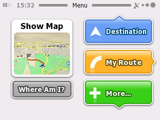
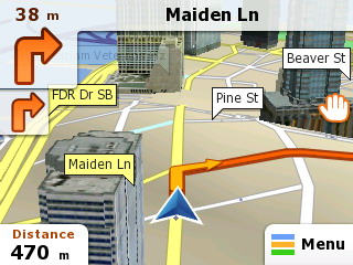
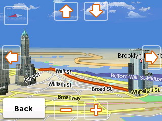
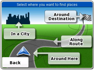
iGO amigo is an easy to use, simple to learn navigation software. The software contains all essential navigation functions on a fresh, user-friendly interface. All this is built on a rock solid foundation.


Main features
Rapid device porting
Customized content sets
Differentiated skins
Economical memory usage
Latest Map Guarantee
Supporting all major operating systems.

Detailed features
Rapid device porting
Turnkey or customized software solutions, experienced in rapid device porting which reduces the time-to-market period significantly.
 Economical memory usage
Economical memory usage provides high performance even on low-end navigation devices.
 Customized content sets
Customized content sets and transparent licensing policy make content integration extremely fast and simple.
 Differentiated skins
A number of innovative and differentiated skins are available on an exclusive basis
 Supporting all major operating systems
Supporting all major operating systems such as Windows CE, Android, iPhone and more
 Latest Map Guarantee
Latest Map Guarantee eliminates any worries about out-of-date stock by guaranteeing a one-time free map update from Naviextras.com after purchasing the device
 Global map coverage
We offer maps for 70 countries, including full Europe, North America, and certain countries of South America; and we are continuously expanding our map portfolio.
 Local language support
iGO amigo voice guidance is available in 43 languages, which also means that if you want to keep your eyes firmly on the road, you can rely entirely on the voice guidance while driving.
 Proven Engine
Built on our iGO Navigation engine which has already proven its abilities and reliability in iGO primo and iGO Classic navigation software platforms, iGO amigo differs from these in its construction and appearance.
 Route overview
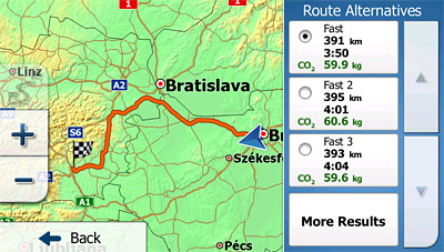
The overview presents the route variants (fast, short, economical, and easy-to-follow) and their most important properties on a top-down map, and gives users freedom of choice.
 Smart Keyboard
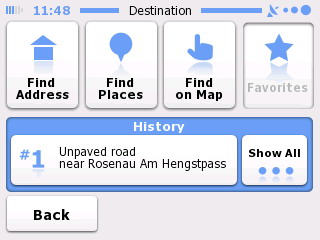
The smart keyboard speeds up the process of entering city and street names by offering the most likely matching choices based on previously used destinations and on city population sizes. The smart history 'learns' the user's behavior and habits: It offers a ranked list with the most likely destinations based on the current GPS position and previous routes.
 Further sophisticated route calculation
iGO amigo calculates not only fast, short, and economical route variants, but also easy-to-follow routes, which include fewer and simpler maneuvers, using main roads where possible.
 'Where am I?'
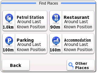
iGO amigo's 'Where am I?' function helps users in emergency situations: This function specifies the current GPS position, and helps in locating nearby assistance, such as a police station, ambulance, break-down service, etc.
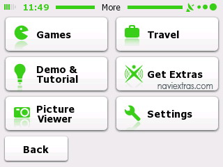
 Integrated tutorial
iGO amigo comes with a brief integrated tutorial slide-show which explains all the important features to first time users who have never tried GPS navigation before.
 Vehimarkers
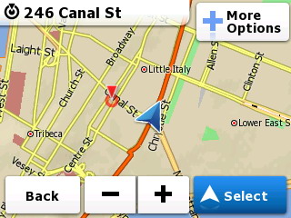
With iGO amigo, users can select different images for their position markers, so the traditional arrow may be changed to a variety of realistic 3D symbols, including pedestrian, bicycle and numerous models of cars.

iGO_amigo_screenshot

iGO_amigo_screenshot

iGO_amigo_screenshot

iGO_amigo_screenshot

iGO_amigo_screenshot

iGO_amigo_screenshot

iGO_amigo_screenshot

iGO_amigo_screenshot

iGO_amigo_screenshot


Download iGO Amigo Map Updates and Extras

How it works
Connect your device or the SD card to your computer
Go to www.naviextras.com
Create a free user account
Download Naviextras Toolbox, a free PC-tool, that connects your device to the PC and automatically scans for installed software and maps
Pick your map or content package and proceed to payment
Follow the prompts to install your latest maps… and you’re ready to hit the road!


Keywords: GPS Maps, GPS Software, Tutorial, Tutorials,  Download, Downloads, NEWS,iGO amigo.


Friday, March 30, 2012

iGO primo


Simply Advanced Navigation
iGO primo®, the flagship OEM product in the iGO Navigation range combines simplicity of use with the most recent technological advances in features and functionality.

Main Features
State-of-the-art intuitive UI
Truck features
Latest Map Guarantee
Connected features
Intuitive features
Fleet and mobile resource management
HD 3D Visual Experience

Detailed Features
Intuitive features
  • Congestion detour
  • Real-time route alternatives
  • Hints upon detour
  • Parking around destination

Visualization
  • High Definition Terrain Visualization
  • Additional Visualization Highlights
  • Breadcrumb Trail

Destination search
  • Smart Keyboard
  • Smart History
  • Point Addressing
  • Picture Navigation
  • Additional Search Highlights

Routing
  • Historical speed
  • Green Routing
  • Time Sense
  • Quick Planning
  • Real route alternatives
  • Additional Routing Highlights

Guidance
  • Real Junctions
  • Tunnel view
  • Lane Guidance and Real Signposts
  • Driver Alerts
  • Proximity Alerts
  • Additional Guidance Highlights
  • Support for 4WD routing (Australia)
  • Voice Guidance
  • TTS Pro

Traffic
  • Visualization of the direction of traffic events
  • Traffic

User interface and workflow
  • Design objectives
  • User-configurable 
  • Convenience Features

Additional features
  • Driver profiles
  • Outdoor Features
  • Application suite
  • Localization

  • Truck Navigation
  • SLAPI 1.2 for fleet management
  • User Speedcams
  • Branding and customization
  • Miscellaneous Application Features
iGO primo new

iGO primo Green Routing

iGO primo Driver Alerts

iGO primo Country Info

iGO primo Main menu

iGO primo Quick Planning

iGO primo Real Signpost

iGO primo Route Alternatives

iGO primo Route Variants

iGO primo Terrain Visualization

iGO primo Terrain Visualization

iGO primo Track log with Speed Profile

iGO primo Traffic

iGO primo Traffic

iGO primo Trip Real Junctions

iGO primo Truck Settings

iGO primo Truck Settings


Download iGO Primo Map Updates and Extras

How it works
Connect your device or the SD card to your computer
Create a free user account
Download Naviextras Toolbox, a free PC-tool, that connects your device to the PC and automatically scans for installed software and maps
Pick your map or content package and proceed to payment
Follow the prompts to install your latest maps… and you’re ready to hit the road!


Keywords: GPS Maps, GPS Software, Tutorial, Tutorials,  Download, Downloads, NEWS,iGO primo, video, Video Tutorial.


iGO primo app

iGO My way for iPhone
Your complete 3D navigation for iPhone
Powered by the same experienced iGO Engine used in millions of navigation devices around the world: now faster & more reliable than ever before, with a set of new features for even more intelligent navigation.

Main Features
Google local search
Green routing
Extras through in-app purchase
Free traffic (only in Western European countries)
Navigation to coordinates
TTS Pro (advanced speech)
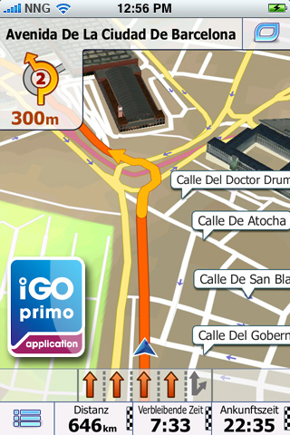
Realistic, 3D Junctions

Detailed features
Stunning 3D visualization
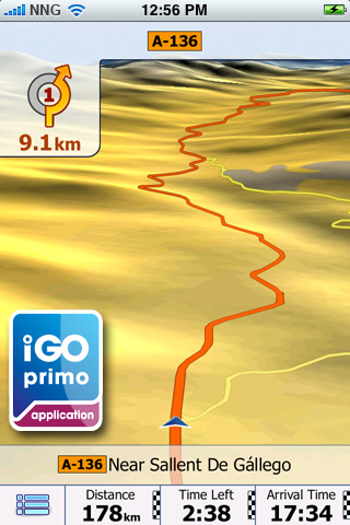
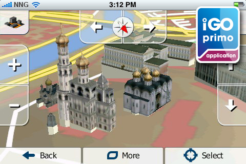
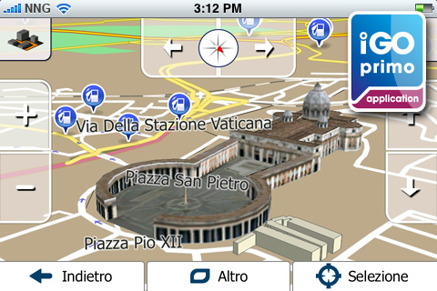
iGO primo app offers stunning 3D visualization. Complex junctions are displayed in 3D to provide a rapid understanding of your next maneuver while true-to-life 3D models of famous landmarks and display of the terrain around you - such as valleys, hills and mountains.

 TTS Pro
The Text-to-Speech (TTS) feature allows pronouncing city, street and highway names as part of the guidance instructions. The new TTS Pro reads out not only standard voice commands, but also traffic events, a summary of the planned route and relevant country info after crossing a border. Text-to-Speech is available in the following languages: English, French, German, Italian, Spanish, Portuguese, Russian. Note: The languages mentioned above vary in the applicable packagages.

 Google local search
Find businesses or anything else you need around your position

 In-app purchase for extras
Country maps, safety cameras, Rich POIs (Explorer’s package), Live Traffic: Save time by using the alternative routes generated automatically by your navigation software following the up-to-date traffic information available for your present route.

 Free Live Traffic
Our Europe, Western Europe, Italy, France, Scandinavia, Benelux, Brazil, North America lite, North America, Russia and DACH applications come now with FREE LIVE TRAFFIC information! Save time by using the alternative routes generated automatically by your navigation software following the up-to-date traffic information available for your present route!

 Realistic Junction View
Realistic images of motorway junctions for easier orientation.

 Sophisticated route calculation
iGO primo app calculates not only fast, short, and easy-to-follow routes, but also green ones. The green routing option is new, choose this one for lower fuel consumption and CO2 emission.

 POI search along the route

 Multiple Destination Entry
Navigate to: iPhone contacts, GPS-coordinates, pictures

 Customizable quick menu

 Customizable vehicle profile

 Send a question to Customer Support

 Optimized in-car use
Extra large buttons, simple icons, and a truly intuitive interface with streamlined workflow ensure optimized in-car use and maximum attention to the road.

 Precise voice guidance in numerous language
iGO primo app supports numerous languages. Please check out the description of the individual packages for the list of the languages included.

 QWERTY keyboard
Use the QWERTY keyboard layout with extra large keys in landscape mode to enter an address.

 Supporting multi-point routes
You can now add one intermediate destination to your route. This feature was introduced in version 1.1.

 Calling POIs (Places)
If you find a Point of Interest (POI) that has a phone number, you can call it immediately from the navigation application.

 Quickstart function
No need to remember road names and house numbers. Save an unlimited number of favorites for a quickstart.

 Smart history
The smart history 'learns' the user's behavior and habits, and offers a ranked list with the most likely destinations based on the current GPS position, previous routes, day of the week, and time of day.

 Where am I? - emergency function
Find help in emergency situations! Based on the current GPS position this function diplays nearby assistance, such as police stations, break-down services, ATMs, etc.

 Millions of POIs
Select from millions of Points of Interest along your route or at your destination, and you can easily find nearby hotels, restaurants, ATMs, gas stations, etc.

 Multi-touch screen
You can zoom the map in and out with two fingers - in iPhone style - but for quicker control one-touch operation is also supported.

 Smart Keyboard
The Smart Keyboard speeds up the address entry by completing the most likely city and street names.

 Explore the map
You can freely browse and explore the map in both 2D and 3D mode: zoom, drag, tilt, rotate, and select any point on the map as destination.

 Auto orientation
To make navigation on iPhone really handy, the application selects automatically between portrait and landscape format.

 Lane assistance and realistic signposts
iGO primo app makes navigation easy even in complex situations. Country-specific lane guidance and signposts give you even more realistic help in choosing the right lane well before the upcoming maneuvres.

 Day and Night mode
With changing light conditions when driving into tunnels or at dawn, iGO primo app switches between Day and Night mode.

 Vehimarkers
With iGO primo app, users can select different images for their position markers, so the traditional arrow can be changed to a variety of realistic 3D symbols, including pedestrian, bicycle and numerous car models.

 Navigation resumes after incoming call
Following an incoming call during navigation, iGO primo app simply resumes guidance without any user interaction.

How does it work?

Upgrade to the brand new iGO primo app now!*
Easy to learn – this app is ideal even for people who have never tried GPS navigation before. The maps are part of the application**, for navigation you don’t need cellular network coverage. NO ROAMING FEES, no surprises.

Getting there – easier and faster
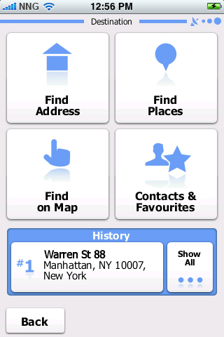
Select your destination — either by searching for an address, a place of interest, or by picking a spot on the map. Our Smart keyboard and Smart search make it easy. Our Adaptive Search Results technology actually learns from your use of the application and tailors search results accordingly.

iGO primo app calculates the route to your chosen destination and displays a map overview along with the most important information, such as journey distance and estimated travel time. Just tap Go! and iGO primo app guides you to your destination with clear voice guidance and a smoothly moving 3D map. Lane assistance and signposts are now country-specific and therefore even more realistic to help you find your way no matter where you go.
Apart from fast, short and easy-to-follow route variants, you can now also use our new Green routing option, for lower fuel consumption and CO2 emission. The route variants are calculated and displayed simultaneously, so you can compare the alternatives visually on the map and pick the one that suits your needs best. You can avoid freeways, ferries, unpaved roads, and toll roads, and the new Avoidances option lets you bypass any road section of the itinerary. You don’t have to worry even if you miss a turn: iGO primo app instantly re-calculates the route.

Installation and setup
Please note that since iPod touch and iPad do not have built-in GPS-receivers, an external GPS-receiver is required. Compatible are only those which are officially supported by Apple. Due to the size of the package, we recommend purchasing and downloading the application via iTunes.

Note: Continuous use of GPS running in the background can dramatically decrease battery life. Background navigation has to be turned on – you can do this under Settings / Advanced settings.

* This update is not available for iPhone 3G devices.
** NNG will make the latest maps available as part of the free software updates, depending on availability. Conditions apply.


Screenshots

iGO primo app for iPhone


iGO primo app for iPhone


iGO primo app for iPhone


iGO primo app for iPhone


iGO primo app for iPhone


iGO primo app for iPhone


iGO primo app for iPhone


iGO primo app for iPhone


iGO primo app for iPhone


iGO primo app for iPhone


iGO primo app for iPhone


iGO primo app for iPhone


iGO primo app for iPhone


iGO primo app for iPhone


iGO primo app for iPhone


iGO primo app for iPhone


iGO primo app for iPhone


iGO primo app for iPhone


iGO primo app for iPhone


Videos

iGO primo app - Your journey starts here


iGO primo app for iPhone sneak peek


Navigate with iGO My way for iPhone


iGO My way for iPhone


iGO primo app all regions

North America Edition
USA + Canada in 4 languages.
Europe Edition
40 European countries in 29 languages.
Western Europe Edition
22 Western European countries in 13 languages.
Eastern Europe Edition
20 Eastern European countries in 17 languages.
Eastern Europe Region Edition
6 Eastern European countries in 17 languages.
UK and Ireland Edition
UK and Ireland in 13 languages.
Scandinavia Edition
4 Scandinavian countries in 9 languages.
France Edition
France in 7 languages
Italy Edition
Italy in 5 languages
Benelux Edition
Benelux in 13 languages.
DACH Edition
DACH in 13 languages.
Iberia Edition
Iberia in 13 languages.
Czech Republic and Slovakia
Czech Republic and Slovakia in 17 languages
Hungary and Romania Edition
Hungary and Romania in 17 languages.
Southern Africa Edition
6 African countries
India Edition
India in 7 languages
Russia Edition
Russia in 17 languages.
Israel Edition
Israel in 29 languages.
Middle East Edition
7 countries of Middle East in 6 languages.
Costa Rica Edition
Costa Rica in 5 language.
Chile Edition
Chile in 7 languages.
Colombia Edition
Colombia in 7 languages.
Argentina Edition
Argentina in 7 languages.
Brazil Edition
Brazil in 7 languages.
Australia and New Zealand Edition
Australia + New Zealand in 11 languages.
Turkey Edition
Turkey in 19 languages.

Download


Keywords: GPS Maps, GPS Software, Tutorial, Tutorials, Video Tutorials, Download, Downloads, video,NEWS,iGO primo app,iPhone.


Wednesday, March 14, 2012

TomTom Maps


As one of the world’s leading satnav providers, TomTom knows that great in-car navigation relies on the best quality map possible. Our research has shown that 15% of roads change every year – so if you want to keep enjoying fast and accurate navigation, your map needs to stay up to date.

That’s why TomTom does everything in its power to give you the best map right from the start.

We have one of the world’s leading digital mapping providers at the heart of our business. And this mapping expertise underpins a whole range of innovative features within our maps. Among these is our market-leading IQ Routes™ technology, which uses actual speed data collected from millions of users to accurately calculate the travel time of your route.

Plus, we provide all sorts of clever and cost-effective ways to help you keep your map up-to-date:

1.First of all, there’s our latest map guarantee. If a new map is available within 30 days of first using your device, you can download that map for free by connecting your device to your internet enabled computer.

2.Then there’s TomTom’s Map Update Service. This gives you every single release of your map over a fixed period for a great price and what’s more the newer you map is, the less you’ll pay.

3.To give your map a boost between updates, there’s TomTom Map Share™. This free service is unique to TomTom, letting you make simple changes to your map and receive changes from Map Share’s 16 million-strong user community.
NOTE: Map Share is not currently supported by My TomTom

4.And if you’re holidaying abroad or travelling somewhere new for business, why not pack your TomTom device and choose a travel map from our selection of more than 90 countries, covering over 30 million kilometres of road.

 TomTom offers maps for more than 95 destinations worldwide. We release maps every quarter with the latest road changes, Points of Interest and speed limits.

TomTom devices
TomTom GO LIVE Top Gear edition
GO 1015 
GO LIVE 1015 
GO LIVE 820/825 
GO 1000 
GO LIVE 1000 
GO 1005 
GO LIVE 1005 
GO 300/500 
GO 510/710 
GO 520/720 
GO 530/630/730 
GO 550/750 
GO LIVE 550/750 
GO 700 
GO 7000 
GO LIVE 540/740 
GO 9000 
GO 910 
GO 920 / GO 920 T 
GO 930 / GO 930 T 
GO LIVE 940 
GO 950 
GO LIVE 950 
START 20 
START 25 
VIA 110/120 
VIA LIVE 115/120/125 
START2 
START XL 
START 
White Pearl 
ONE XL 
ONE IQ Routes Edition 
ONE 3rd Edition 
ONE 2nd Edition 
ONE (30 Series) TTS 
ONE (30 Series) 
ONE 
XXL Classic 
XXL 550 
XXL 
XL IQ Routes Edition2 
XL IQ Routes Edition LIVE 
XL IQ Routes Edition 
XL Black Edition 
XL Black Edition TTS 
XL 350 
XL (30 Series) TTS 
XL (30 Series) 
RIDER 
RIDER 2nd Edition 
Urban Rider / Rider Pro 
Toyota II (TNS410) 
Toyota Aygo Connect Multimedia 
Toyota (TNS400) 
Subaru (H001SSC800) 
Sony XNV Navigation Module LIVE 
Sony XNV Navigation Module 
Carminat TomTom LIVE 
Carminat TomTom 
Mazda Navigation (NVA-SD8110) 
Blue&Me TomTom 2 
Blue&Me TomTom 2 LIVE 
Blue&Me TomTom 
Eclipse II (AVN 4429 / 4430 / 4400) 
Eclipse (AVN 2210p / 2227p) 
Mobile Phone 
TomTom Connect 
TomTom Connect LIVE 
PRO 7100 
PRO 7150 
PRO 9100 
PRO 9150 
Mazda Navigation System NB1 
Mazda Navigation System NB1 LIVE

(Windows) For GO, XL, XXL, ONE, START, RIDER and NAVIGATOR 6 and 7 devices.
(MAC OSX) For all GO, ONE, XL, XXL, START and RIDER devices.

TomTom HOME is the easiest way to manage content on your TomTom device. Downloading and installing HOME is easy and quick. Once installed, simply connect your TomTom device to your computer by using your USB cable and get started. 

Every time you start up TomTom HOME, it will automatically detect if your TomTom device is connected and offer you any available updates. Connect often to get the latest and the greatest!


Keywords:GPS Maps, GPS Software, NEWS, Tutorial, Tutorials, Downloads.

Monday, February 20, 2012

RO.A.D.2012.20 a fost lansat


Lansare RO.A.D.2012.20


Sheba Distribution SRL, reprezentant al firmei Garmin înRomania, are plăcerea să anunţe disponibilitatea noii ediţii a Atlasului Digital al României v4.02, RO.A.D.2012.20.
Continuând în tradiţia binecunoscută deja clienţilor Garmin din România, Atlasul Digital al României se menţine în continuare pe locul I în clasamentul hărţilor de navigaţie rutieră, aducând în plus faţă de ediţia precedentă peste 11 mii de kilometri de drumuri, ridicând la un total de 236.802,97 km de căi de comunicaţii acoperirea în teritoriu, iar numărul de informaţii de tip punct se ridică în această ediţie la 299.184 puncte împărţite în 435 de categorii.
 ROAD2012.20 este singura hartă de navigaÅ£ie din lume care combină detalii topo cu o structură de drumuri rutabilă – la nivel inclusiv de drumuri de pământ ÅŸi poteci – cu adrese poÅŸtale de o precizie neegalată, oraÅŸe cu blocuri 3D ÅŸi modele minuÅ£ios realizate la construcÅ£ii vechi, de patrimoniu, sau noi, definitorii pentru peisajul urban actual.
Faţă de hărţile obişnuite de pe piaţă, Atlasul Digital al României are un grad de actualitate fără egal, în această ediţie găsindu-şi locul binemeritat centurile de la Domaşnea, Caransebeş şi Drobeta Turnu Severin, Pasajul Pipera 2 precum şi multe sensuri unice şi giratorii apărute între timp.
Galeria modelelor 3D s-a îmbogăţit cu reprezentările detaliate ale Universităţii de Apărare Carol I din Bucureşti, ale Arenei Naţionale, restaurantului Capşa si Bisericii Patriarhiei Române din Bucureşti.
PasionaÅ£ii de istorie vor descoperi în această ediÅ£ie în premieră elementele de detaliu ale Cetăţii de epoca fierului de la Teleac, ale cetăţilor medievale de la Enisala ÅŸi de la Cluj-Napoca ÅŸi ale aÅŸezării fortificate de epoca bronzului de la CorneÅŸti  precum ÅŸi ale multor alte obiective de interes istoric sau arheologic.
Dispunând de un concept original, cu actualizări trimestriale, rodul muncii pasionaţilor şi specialiştilor din echipa Proiectului România Digitală , Atlasul Digital al României este opţiunea profesioniştilor din toate domeniile şi unealta preferată de navigaţie a pasionaţilor de drumeţii în aer liber.
Ediţia actuală are 480 MB mărime şi rulează exclusiv pe echipamente de navigaţie Garmin, o listă a acestora fiind disponibilă mai jos

O versiune pentru PC pe platforma MapSource este în lucru şi planificată să fie lansată spre sfârşitul lunii martie 2012.

1.
Dakota 20;
2. Edge 605 ÅŸi 705;
3. eTrex Venture CX;
4. eTrex Vista HCX ÅŸi eTrex Legend HCX;
5. Gpsmap 60 CX, 60 CSX ÅŸi 76 CX, 76 CSX;
6. Gpsmap 62, 62s, 62st, 78, 78s;
7. toate Nuvi 2xx (Nuvi 2x0,2x0W, 2x5, 2x5W);
8. Nuvi 5xx;
9. Nuvi 6xx;
10. Nuvi 7x5;
11. Nuvi 12xx;
12. Nuvi 13xx ÅŸi 14xx;
13. Nuvi 37xx;
14. Nuvi 300 ÅŸi 350;
15. Nuvi 310, 360 ÅŸi 370;
16. Nuvi 2360;
17. Oregon 200, 300 ÅŸi 400;
18. Oregon 450, 550, 450T ÅŸi 550T;
19. Zumo 4xx ÅŸi 5xx;
20. Zumo 660;
21. Gpsmap 620;
22. Gpsmap 420s;
23. Gpsmap 526s.

24.11.2011
Se poate instala harta şi pe următoarele dispozitive:
1. Colorado
2. Montana 6xx
3. Nuvi 1490TV
4. Nuvi 7xx
5. Nuvi 3490

16.01.2012
Se poate instala harta şi pe următoarele dispozitive:
1.GVN-52
2.Nuvi 24x0
3.Nuvi 24x5 ÅŸi 25x5

24.01.2012
Se poate instala harta şi pe următorul dispozitiv:
1.StreetPilot C3x0

Versiunea Mapsource va fi şi ea una modificată şi va beneficia astfel de capabilitatea de a citi hărţile criptate, care sunt disponibile acum doar pe terminalele Garmin cu firmware modificat.

RO.A.D. este o marca înregistrată a Sheba Distribution SRL.


Keywords: Downloads, Garmin, GPS Maps, GPS Software, Imagini RO.A.D.2012.20, NEWS, Prezentare RO.A.D.2012.20, Romania digitala, Tutorials.


Monday, January 30, 2012

City Navigator® Europe NT 2012.30

Features

•Includes full country coverage for Western Europe and many countries in Eastern Europe as well as French Guiana and the islands of Malta, St. Barthélemy, Martinique, Guadeloupe and Réunion.
•Includes increased detailed coverage for Romania and Ukraine.
•Includes more than 10.2 million km (6.3 million mi) of roads, including motorways, national and regional thoroughfares and local roads, in Western Europe and many countries in Eastern Europe.
•Displays more than 4.9 million points of interest throughout the country, including restaurants, lodging, border crossings, attractions, petrol stations, campsites, shopping and more.
•Gives turn-by-turn directions on your compatible device.
•Enhances pronunciation for compatible devices that speak street names (example: "Turn right on Main Street").
•Includes navigational features, such as turn restrictions, roundabout guidance, speed categories and more.
•Contains traffic data for compatible devices that use traffic receivers.
•(DVD only) Includes computer software that lets you plan trips on your computer and transfer waypoints, routes and tracks between your computer and your device.


Coverage Details


Great Britain and Republic of Ireland
◦Great Britain: Full coverage
◦Scotland: Full coverage
◦Wales: Full coverage
◦Isle of Man: Full coverage
◦Northern Ireland: Full coverage
◦Ireland: Full coverage
◦Channel Islands: Full coverage
Denmark, Finland, Iceland, Norway, and Sweden
◦Denmark: Full coverage
◦Finland: Full coverage
◦Iceland: Full coverage
◦Norway: Full coverage
◦Sweden: Full coverage
France and Benelux
◦Andorra: Full coverage
◦Belgium: Full coverage
◦France: Full coverage
◦French Guiana: Coverage for most urban areas
◦Guadeloupe: Coverage for most urban areas
◦Martinique: Coverage for most urban areas
◦Netherlands: Full coverage
◦Luxembourg: Full coverage
◦Réunion: Coverage for most urban areas
◦Saint Barthélemy: Full Coverage
Italy, Austria, Switzerland, and Liechtenstein
◦Italy: Full coverage
◦Austria: Full coverage
◦Switzerland: Full coverage
◦Liechtenstein: Full coverage
Malta
◦Malta: Full coverage
Spain and Portugal
◦Spain: Full coverage
◦Portugal: Full coverage
◦Gibraltar: Full coverage
◦Azores Islands: Full coverage
◦Canary Islands: Full coverage
◦Baleric Islands: Full coverage
◦Madeira: Full coverage
Germany
◦Germany: Full coverage
Czech Republic
◦Czech Republic: Full coverage
Greece
◦Greece: Full coverage
Eastern Europe
◦Estonia: Full coverage
◦Latvia: Full coverage
◦Lithuania: Full coverage
◦Poland: Full coverage
◦Slovakia: Full coverage
◦Hungary: Full coverage
◦Slovenia: Full coverage
◦Croatia: Full coverage
◦Bulgaria: Full coverage
◦Romania: Coverage for most urban areas
◦Turkey: Full coverage
◦Moldova: Major roads only
◦Bosnia & Herzegovina: Major roads only
◦Serbia & Kosovo: Full Coverage
◦Montenegro: Coverage for most urban areas
◦Albania: Major roads only
◦Republic of Macedonia (FYROM): Coverage for most urban areas
◦Belarus: Major roads only
◦Ukraine: Coverage for most urban areas

Compatible Devices

aera® 500  aera® 510  aera® 550  aera® 560  Astro® 220  Astro® 320  Colorado® 300  Colorado® 400c  Colorado® 400i  Colorado® 400t  dÄ“zl™ 560LMT  dÄ“zl™ 560LT  Dakota® 10  Dakota® 20  Edge® 605  Edge® 705  Edge® 800  eTrex Legend® Cx  eTrex Legend® HCx  eTrex Venture® Cx  eTrex Vista® Cx  eTrex Vista® HCx  eTrex® 20  eTrex® 30  G60  GPSMAP® 60CSx  GPSMAP® 60Cx  GPSMAP® 62  GPSMAP® 620  GPSMAP® 62s  GPSMAP® 62sc  GPSMAP® 62st  GPSMAP® 62stc  GPSMAP® 640  GPSMAP® 76CSx  GPSMAP® 76Cx  GPSMAP® 78  GPSMAP® 78s  GPSMAP® 78sc  LIVE 1695  Montana™ 600  Montana™ 650  Montana™ 650t  nüvi® 1100  nüvi® 1100LM  nüvi® 1200  nüvi® 1250  nüvi® 1260T  nüvi® 1300  nüvi® 1300LM  nüvi® 1350  nüvi® 1350LMT  nüvi® 1350T  nüvi® 1360  nüvi® 1370T  nüvi® 1390LMT  nüvi® 1390T  nüvi® 1450  nüvi® 1450LM  nüvi® 1450LMT  nüvi® 1450T  nüvi® 1490LMT  nüvi® 1490T  nüvi® 1690  nüvi® 200  nüvi® 200W  nüvi® 205  nüvi® 205W  nüvi® 2200  nüvi® 2250  nüvi® 2250LT  nüvi® 2300  nüvi® 2300LM  nüvi® 2350  nüvi® 2350LMT  nüvi® 2350LT  nüvi® 2360LMT  nüvi® 2360LT  nüvi® 2370LT  nüvi® 2450  nüvi® 2450LM  nüvi® 2455LMT  nüvi® 2455LT  nüvi® 2460LMT  nüvi® 2460LT  nüvi® 2475LT  nüvi® 2495LMT  nüvi® 250  nüvi® 250W  nüvi® 255  nüvi® 2555LMT  nüvi® 2555LT  nüvi® 255W  nüvi® 2595LMT  nüvi® 260  nüvi® 260W  nüvi® 265T  nüvi® 265WT  nüvi® 270  nüvi® 275T  nüvi® 285WT  nüvi® 295W  nüvi® 30  nüvi® 3450  nüvi® 3450LM  nüvi® 3490LMT  nüvi® 3550LM  nüvi® 3590LMT  nüvi® 3750  nüvi® 3760LMT  nüvi® 3760T  nüvi® 3790LMT  nüvi® 3790T  nüvi® 40  nüvi® 40LM  nüvi® 465LMT  nüvi® 465T  nüvi® 50  nüvi® 500  nüvi® 50LM  nüvi® 550  nüvi® 750  nüvi® 755T  nüvi® 760  nüvi® 765T  nüvi® 770  nüvi® 775T  nüvi® 780  nüvi® 785T  nüvi® 850  nüvi® 855  nüvi® 880  nüvi® 885T  Oregon® 200  Oregon® 300  Oregon® 400c  Oregon® 400i  Oregon® 400t  Oregon® 450  Oregon® 450t  Oregon® 550  Oregon® 550t  Rino® 520HCx  Rino® 530HCx  Rino® 610  Rino® 650  Rino® 655t  StreetPilot® 7200  StreetPilot® 7500  zÅ«mo® 220  zÅ«mo® 450  zÅ«mo® 550  zÅ«mo® 660  zÅ«mo® 665

Download City Navigator Europe NT 2012.30


Saturday, January 21, 2012

RO.A.D.2012.10


Lansare RO.A.D.2012.10

Vechi si nou intr-o viziune tehnologica moderna, in cea mai noua editie a Atlasului Digital al Romaniei, RO.A.D.2012.10

Dupa un efort de aproape 3 ani, echipa de la Sheba Distribution SRL, distribuitorul Garmin in Romania (www.garmin.ro) si conducatorul Proiectului Romania Digitala (www.romaniadigitala.ro) are deosebita placere sa anunte disponibilitatea noului Atlas Digital al Romaniei, RO.A.D.2012.10.

Cu peste 1200 de localitati din Romania la nivel de detaliu, cu acoperire din Delta Dunarii si pana in varful Muntilor Carpati, Atlasul Digital al Romaniei beneficiaza de ultimele avansuri tehnologice disponibile pe platformele de varf ale dispozitivelor de navigatie Garmin.

Tehnologia 3D a permis – pe baza studiilor fundamentate istoric si arheologic in literatura de specialitate – reconstituirea unor monumente istorice inregistrate in patrimoniul UNESCO din trecutul Romaniei, cum ar fi Cetatile dacice din Muntii Orastiei: Costesti, Blidaru, Piatra Rosie si incinta sacra de la Sarmizegetusa Regia. Nici realizarile de exceptie ale cuceritorilor romani nu au fost lasate ignorate, in Atlas putandu-se vizualiza cladirile magnifice ale Palatului Augustaliilor si Amfiteatrului Roman de la (Ulpia Traiana) Sarmizegetusa, impreuna cu castrele de la Drobeta, Buciumi si Bologa. O atentie deosebita a fost acordata reconstituirii Podului lui Apolodor din Damasc de la Drobeta, care facea legatura in trecut intre castrele Pontes (din Bulgaria) si Drobeta si pe care au trecut in Dacia armatele lui Traian in al doilea razboi dacic (105-106 e.n.).

Reconstituirile 3D sunt doar partea cea mai spectaculoasa a unui efort de a realiza primul repertoriu topografic al tuturor fortificatiilor din Romania, din toate perioadele istorice: neolitic, epoca bronzului, epoca fierului, perioada Latene si stapanirea romano-bizantina, epoca migratiilor, feudalism si epoca moderna. S-au identificat si plasat pe harta sute de fortificatii. La o parte din acestea s-au publicat planurile trase la scara si georeferentiate, astfel incat cei interesati pot ajunge, ghidati de GPS-urile Garmin pe drumuri de pamant si poteci de munte, sa viziteze locurile in care s-a scris istoria acestei tari.

Din istoria medievala s-au modelat de asemenea 3D monumente valoroase consacrate ca atare in patrimoniul UNESCO: bisericile de la Voronet, Moldovita, Sucevita, Putna si Arbore. Mari atractii turistice medievale ale Romaniei sunt si ele prezente: Bisericile fortificate de la Viscri si Valea Viilor, Castelul Bran si Castelul Huniazilor.

Din patrimoniul modern de valoare al Romaniei amintim Palatul Peles si Pelisor de la Sinaia, Palatul Culturii de la Iasi si Palatele Elisabeta, Ghica, Cantacuzino din Bucuresti. Cladirile publice monument istoric au fost modelate cu grija si atentie la detalii fiind peste 50 la numar numai in Bucuresti bunaoara: Palatele BNR, Palatul CEC, Palatul Patriarhiei, Muzeul National de Istorie, Palatul Scoalelor, Palatul de Justitie, sediul MAI, Primaria Municipiului Bucuresti si multe, multe altele. Nu putea lipsi o cladire emblematica pentru Romania contemporana: Palatul Parlamentului. In general s-au modelat cladiri moderne si contemporane valoroase arhitectonic: Palatul Telefoanelor, Ateneul Roman, Biblioteca Centrala Universitara, Muzeul National de Arta al Romaniei, Opera Romana, etc.precum si monumente industriale: Podul Carol I (cunoscut si ca Podul Saligny) de cale ferata de la Cernavoda si Podul rutier in arc de la Agigea.

Fata de alte implementari prezente pe piata, modelele 3D din Atlasul Digital al Romaniei sunt elaborate si finisate cu mare atentie la detalii, contribuind si la experienta estetica a calatoriei si pregatirii acesteia, nu doar la cea vizuala/orientativa.

In Bucuresti s-a demarat un amplu program de introducere al restrictiilor de incadarare in banda. Conducatorii auto vor fi avertizati din timp pe ce banda sa se incadreze pentru realizarea anumitor manevre. De-a lungul tuturor autostrazilor s-au implementat indicatii vocale speciale si de incadrare in banda pentru ca soferii sa fie avertizati din timp si cu maximum de acuratete asupra manevrelor de efectuat. Acoperirea cu drumuri s-a extins in judetele Giurgiu, Tulcea, Constanta, Braila, Brasov, Mures, Bistrita-Nasaud, Mures si Sibiu.

Peste o suta de sensuri giratorii noi au fost implementate in harta. Fata de harti provenind de la firme de prestigiu din domeniu din strainatate (CNE2012.30 cu date de la Navteq), Atlasul Digital al Romaniei RO.A.D.2012.10 aduce in plus acoperire de ultima ora fara egal:
- centura Sibiu;
- autostrada Timisoara-Arad (se deschide pe 15 decembrie);
- autostrada A2 de la Murfatlar la Lazu impreuna cu nodul mare de autostrazi si portiunea din A4 pana la DN3;
- autostrada A3 completa, incluzand bucata Turda – Campia Turzii si nodul de la Turda;
- ocolitoarea Adunatii Copaceni pe DN5;
- ocolitoarea Valcele-Apahida (zona Cluj);
- centura NE Timisoara (intre DN6 si DN69);
- centura de nord Bucuresti incluzand podul de la Otopeni;
- spatiile de servicii de pe A2 Bucuresti-Cernavoda;
- Pasajul Basarab complet, strapungerile 1 Mai-Marinescu si Matei Basarab;
- varianta noua de rutare de la Razoare (!) data in folosinta acum cateva zile.

Pe langa acestea s-au adaugat foarte multe solutii de acces la centre mari comerciale, cel mai nou fiind cel de la Colloseum in Bucuresti. Peste 30 de orase mari au implementate blocurile extrudate 3D pentru o experienta de navigatie fara egal.

Harta s-a marit de la 395 MB la 470 MB si beneficiaza de o tehnologie noua de criptare care necesita actualizarea firmware-ului de pe aparate. RO.A.D.2012.10 este, la data acestui anunt, disponibila doar pentru urmatoarele familii de aparate GPS Garmin:

1. Dakota 20;
2. Edge 605 si 705;
3. Etrex Venture CX;
4. Etrex Vista HCX si etrex Legend HCX;
5. gpsmap 60 CX, 60 CSX si 76 CX, 76 CSX;
6. gpsmap 62, 62s, 62st, 78, 78s si 78st;
7. toate Nuvi 2xx (Nuvi 2×0, 2x0W, 2×5, 2x5W);
8. Nuvi 5xx;
9. Nuvi 6xx;
10. Nuvi 7×5;
11. Nuvi 12xx;
12. Nuvi 13xx si 14xx;
13. Nuvi 37xx;
14. Nuvi 300 si 350;
15. Nuvi 310, 360 si 370;
16. Nuvi 2360;
17. Oregon 200 si 300;
18. Oregon 450, 550, 450T si 550T;
19. Zumo 4xx si 5xx;
20. Zumo 660;
21. Gpsmap 620;
22. Gpsmap 420s;
23. Gsmap 421s;
24. Gpsmap 526s.


24.11.2011
Se poate instala harta şi pe următoarele dispozitive:
1. Colorado
2. Montana 6xx
3. Nuvi 1490TV
4. Nuvi 7xx
5. Nuvi 3490

16.01.2012
Se poate instala harta şi pe următoarele dispozitive:
1.GVN-52
2.Nuvi 24x0
3.Nuvi 24x5 ÅŸi 25x5

24.01.2012
Se poate instala harta şi pe următorul dispozitiv:
1.StreetPilot C3x0


Cu ocazia lansarii noului RO.A.D. re-lansam si situl Proiectului Romania Digitala www.romaniadigitala.ro. Realizat de creatorii modelelor 3D din harta, Symmetric Studios SRL (Hunedoara, Timisoara, www.symmetricstudios.com), situl beneficiaza de un look modern si atractiv si un nivel sporit de interactivitate .

Noile actualizari la harta se vor succeda in ritm trimestrial de acum incolo, urmatoarea editie a Atlasului, RO.A.D.2012.20 fiind planificata pentru 18 februarie 2012, cand se estimeaza si disponibilitatea acesteia pe PC in programul MapSource.

RO.A.D. este o marca inregistrata a Sheba Distribution SRL.

Puncte de interes

Instructiuni de utilizare
Descarcati de pe www.garmin.com programul POI Loader si il instalati pe PC. Descarcati fisierul PROX_POI.csv (clic dreapta, apoi Save Target As) intr-un director aparte. Conectati dispozitivul Garmin la calculator si asteptati sa fie recunoscut de sistem. Porniti POI Loader, alegeti dispozitivul Garmin, alegeti calea catre locul unde se afla fisierul PROX_POI.csv, bifati kph/meters si modul Express, apoi Send.


Download RO.A.D.2012.10 Maps PROX_POI.csv
Numarul total de inregistrari a ajuns la 500 alerte.


Keywords: Downloads, Garmin, GPS Maps, GPS Software, Imagini RO.A.D.2012.10, NEWS, Prezentare RO.A.D.2012.10, Romania digitala, Tutorials, Download,Tutorial.