Showing posts with label Tutorial. Show all posts

Tuesday, December 31, 2013

Samsung I9100 Galaxy S2 Hard Reset-Factory Reset

What to do before performing the hard reset?
- In case your Samsung mobile phone can connect to a computer then it is better to make a backup of your saved data using Samsung kies software.

Samsung I9100 Galaxy S2 Hard Reset Steps:
- Take out your phone's battery, SIM-card and memory card too.
- After 10 seconds put the battery back into your phone.
- Press and hold Volume Up key + Home key then press Power key.
- Keep pressing the above keys until Samsung logo appears for the second time, Then release all keys.
- You will be into Factory reset menu.
- Use Volume Down key to select Wipe Data / Factory Reset option.
- Use Power key to confirm the operation.
- You need to use the Volume Down key again to select "Yes delete all user data"
- Use Power key to confirm.
- After performing the hard reset, Select Reboot System Now option, And confirm it using Power key.
- Now the phone will reboots, Wait for it to be fully on and then you can start using it.

Notice: The hard reset operation will delete anything that are saved in your phone's internal memory, So make a backup of your data in case you can access them.

Monday, December 30, 2013

What is the difference between CFRoot and CFAutoRoot ?

CF-Root (non-Auto) are manually built rooted kernels and/or flashables that usually provide more than “just root”. CF-Auto-Root is built on an automated system that I am constantly improving that takes a stock recovery image and returns an automated rooting packages. These packages are designed to install and enable SuperSU on your device, so apps can gain root access, and nothing more.

Tuesday, July 16, 2013

Garmin City Navigator® North America NT 2014.10

Navigate the streets with confidence. This product provides detailed road maps and points of interest for your device, so you can navigate with exact, turn-by-turn directions to any address or intersection.

Displays more than 10 million points of interest, including hotels, restaurants, parking, entertainment, fuel and shopping.
Includes postal code support for Canada.
Gives turn-by-turn directions on compatible devices.
Speaks street names (example: "Turn right on Main Street").
Includes navigational features, such as turn restrictions, roundabout guidance and speed categories.
Contains traffic data for compatible devices with traffic receivers.
(DVD version only) Includes Trip-Planning software to plan trips on your computer and transfer waypoints, routes and tracks to your device.

Coverage
Features highways, interstates, and business and residential roads in metropolitan and rural areas in the U.S. and outlaying areas, specifically:

Canada
Mexico
Puerto Rico
U.S. Virgin Islands
Cayman Islands
The Bahamas
French Guiana
Guadeloupe
Martinique
Saint Barthélemy
Jamaica

Garmin City Navigator® North America NT 2014.10


Download Garmin City Navigator® North America NT 2014.10


Keywords: Downloads, GPS Maps,GPS Software, NEWS,Tutorial, Tutorials,MapSource,Download, City Navigator® North America NT 2014.10.


Garmin City Navigator® Europe NT 2014.10

Navigate the streets with confidence. This product provides detailed road maps and points of interest for your device, so you can navigate with exact, turn-by-turn directions to any address or intersection.

Note: This is not a map update. To update the existing maps on your device, check for map updates.
•Includes more than 10.4 million km (6.5 million mi) of roads, including motorways, national and regional thoroughfares and local roads, in Western Europe and many countries in Eastern Europe.
•Displays more than 6 million points of interest throughout the region, including restaurants, lodging, border crossings, attractions, petrol stations, campsites and shopping.
•Gives turn-by-turn directions on compatible devices.
•Enhances pronunciation for compatible devices that speak street names (example: "Turn right on Main Street").
•Includes navigational features, such as turn restrictions, roundabout guidance and speed categories.
•Contains traffic data for compatible devices that use traffic receivers.
•(DVD only) Includes computer software that lets you plan trips on your computer and transfer waypoints, routes and tracks between your computer and your device.

Requirements
Download Requirements
File Information
The file size of this download and space required on device or microSD™/SD™ card is 2.85 GB. If this download does not fit on your device, data may be saved on a microSD/SD card (Recycled microSD cards may be used to program map data).

Please note, these full-version maps do not contain premium content such as junction view or 3-D buildings and terrain. These features only are available on the preloaded maps within your device or through a specific update for the mapping region of your device.

Use with 1 Device Only
This product may be unlocked and used on 1 compatible device. If you want to use this same map on subsequent devices, you must purchase a new map for each device.

Data downloaded to a microSD/SD card is associated with the device you select during the download process. Please purchase additional quantities for additional devices.

Product Compatibility
Make sure your device is compatible with this product before purchasing. Downloadable products are non-refundable.

A card reader and microSD/SD card are required to download mapping to the following devices: eTrex® Legend Cx/HCx, Vista Cx/HCx, Venture Cx; GPSMAP® 60CSx/60Cx; GPSMAP 76CSx/76Cx; Rino® 520HCx/530HCx; Astro® 220; StreetPilot® 7200/7500 (not all devices are compatible with all downloads).

Download Times
Not for use with dial-up Internet access or satellite Internet providers. Actual download speeds may vary.

Expiration Date
You have 1 year from the date of purchase to download this file.

Minimum Requirements
The download process requires you to install the free Garmin Communicator Plugin on your computer so we can communicate with your device. Note: The download is installed directly to your device or microSD/SD card and is not accessible on the computer.
Windows®
•Windows XP SP3 or newer
•1 GB RAM
•1024 x 768 display
•USB port
•4 GB free disk space
•Microsoft .NET Framework 4 Client Profile (included)
•High speed Internet access
Mac®
•Any Intel-based Mac
•OS X 10.5.8 or later
•1 GB RAM
•1024 x 768 display
•USB port
•4 GB free disk space
•High speed Internet access


MicroSD™/SD™ card Requirements
Make sure your device is compatible with this product before purchasing.

To view and use the maps on this card, you must have a device with a microSD or SD card slot. Maps on microSD/SD cards cannot be copied or viewed on a computer.

Reduced price map updates are not available for these cards. If you want to update the maps, you must purchase a new card that includes the latest map data.

The microSD/SD card package includes a microSD card and an SD card adapter.

DVD Requirements
Make sure your device is compatible with this product before purchasing.

This product may be unlocked and used on 1 compatible device. If you want to use this same map on subsequent devices, you must purchase a new map for each device.

You cannot use this product to update the maps on your preloaded device. To order updated map data for your preloaded device, visit our Update Maps page.

Before you can download map detail to a memory card or directly to your compatible device, you must unlock this disk (simply follow the instructions on the certificate that comes in the packaging).

Minimum System Requirements
Internet access is required. Includes USB device drivers.
Windows®
•Windows XP SP3 or newer
•1 GB RAM
•At least 1024 x 768 display
•24-bit color monitor
•4 GB free disk space
•USB port
•DVD drive
•Microsoft .NET Framework 4 Client Profile (included)
Mac®
•Any Intel-based Mac
•1 GB RAM
•OS X 10.5.8 or later
•1024 x 768 display
•4 GB free disk space
•USB port
•DVD drive

Coverage
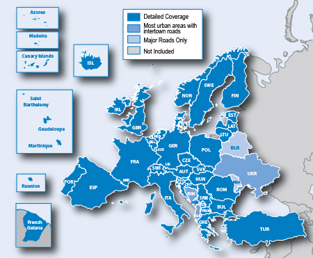
Features full coverage for Romania, Guadeloupe, Martinique, St. Barthélemy and French Guiana, and increased detailed coverage for Bosnia and Herzegovina. Also includes Western Europe and many countries in Eastern Europe, specifically:

Great Britain and Republic of Ireland
•Great Britain: Full coverage
•Scotland: Full coverage
•Wales: Full coverage
•Isle of Man: Full coverage
•Northern Ireland: Full coverage
•Ireland: Full coverage
•Channel Islands: Full coverage

Denmark, Finland, Iceland, Norway, and Sweden
•Denmark: Full coverage
•Finland: Full coverage
•Iceland: Full coverage
•Norway: Full coverage
•Sweden: Full coverage

France and Benelux
• Andorra: Full coverage
• Belgium: Full coverage
• France: Full coverage
• French Guiana: Coverage for most urban areas
• Guadeloupe: Full coverage
• Martinique: Full coverage
• Netherlands: Full coverage
• Luxembourg: Full coverage
• Réunion: Coverage for most urban areas
• Saint Barthélemy: Full Coverage

Italy, Austria, Switzerland, and Liechtenstein
• Italy: Full coverage
• Austria: Full coverage
• Switzerland: Full coverage
• Liechtenstein: Full coverage

Malta
• Malta: Full coverage

Spain and Portugal
• Spain: Full coverage
• Portugal: Full coverage
•Gibraltar: Full coverage
• Azores Islands: Full coverage
• Canary Islands: Full coverage
•Baleric Islands: Full coverage
•Madeira: Full coverage

Germany
• Germany: Full coverage

Czech Republic
•Czech Republic: Full coverage

Greece
•Greece: Full coverage

Eastern Europe
•Estonia: Full coverage
•Latvia: Full coverage
• Lithuania: Full coverage
• Poland: Full coverage
• Slovakia: Full coverage
• Hungary: Full coverage
• Slovenia: Full coverage
• Croatia: Full coverage
• Bulgaria: Full coverage
•Romania: Full coverage
•Turkey: Full coverage
•Moldova: Major roads only
•Bosnia & Herzegovina: Coverage for most urban areas
•Serbia & Kosovo: Full Coverage
•Montenegro: Coverage for most urban areas
•Albania: Major roads only
•Republic of Macedonia (FYROM): Full coverage
•Belarus: Major roads only
•Ukraine: Coverage for most urban areas

Garmin City Navigator® Europe NT 2014.10

Compatible Devices
Compatible with Disk Version
aera® 500
aera® 510
aera® 550
aera® 560
Alpha™
Astro®
Astro® 220
Colorado® 300
Colorado® 400c
Colorado® 400i
Colorado® 400t
Dakota® 10
Dakota® 20
dÄ“zl™ 560LMT
dÄ“zl™ 560LT
dÄ“zl™ 760LMT
Edge® 605
Edge® 705
Edge® 800
Edge® 810
eTrex® 20
eTrex® 30
eTrex Legend® Cx
eTrex Legend® H
eTrex Legend® HCx
eTrex Summit® HC
eTrex Venture® Cx
eTrex Venture® HC
eTrex Vista® Cx
eTrex Vista® H
eTrex Vista® HCx
GPSMAP® 276C
GPSMAP® 278
GPSMAP® 296
GPSMAP® 376C
GPSMAP® 378
GPSMAP® 396
GPSMAP® 478
GPSMAP® 495
GPSMAP® 496
GPSMAP® 60CSx
GPSMAP® 60Cx
GPSMAP® 62
GPSMAP® 620
GPSMAP® 62s
GPSMAP® 62sc
GPSMAP® 62st
GPSMAP® 62stc
GPSMAP® 640
GPSMAP® 76CSx
GPSMAP® 76Cx
GPSMAP® 78
GPSMAP® 78s
GPSMAP® 78sc
iQue® 3000
iQue® M3
iQue® M4
Montana® 600
Montana® 600t Camo
Montana® 650
Montana® 650t
Monterra™
nüLink!® 1690 LIVE
nüLink!® 1695 LIVE
nüvi® 1100
nüvi® 1100LM
nüvi® 1200
nüvi® 1250
nüvi® 1260T
nüvi® 1300
nüvi® 1300LM
nüvi® 1350
nüvi® 1350LMT
nüvi® 1350T
nüvi® 1360
nüvi® 1370T
nüvi® 1390LMT
nüvi® 1390T
nüvi® 1450
nüvi® 1450LM
nüvi® 1450LMT
nüvi® 1450T
nüvi® 1490LMT
nüvi® 1490T
nüvi® 200
nüvi® 200W
nüvi® 205
nüvi® 205W
nüvi® 2200
nüvi® 2250
nüvi® 2250LT
nüvi® 2300
nüvi® 2300LM
nüvi® 2350
nüvi® 2350LMT
nüvi® 2350LT
nüvi® 2360LMT
nüvi® 2360LT
nüvi® 2370LT
nüvi® 2450
nüvi® 2450LM
nüvi® 2455LMT
nüvi® 2455LT
nüvi® 2457LMT
nüvi® 2460LMT
nüvi® 2460LT
nüvi® 2475LT
nüvi® 2495LMT
nüvi® 2497LMT
nüvi® 250
nüvi® 250W
nüvi® 255
nüvi® 2555LM
nüvi® 2555LMT
nüvi® 2555LT
nüvi® 2557LMT
nüvi® 255W
nüvi® 2577LT
nüvi® 2595LMT
nüvi® 2597LMT
nüvi® 260
nüvi® 260W
nüvi® 265T
nüvi® 265WT
nüvi® 270
nüvi® 2757LM
nüvi® 275T
nüvi® 2797LMT
nüvi® 285WT
nüvi® 295W
nüvi® 30
nüvi® 3450
nüvi® 3450LM
nüvi® 3490LMT
nüvi® 3550LM
nüvi® 3590LMT
nüvi® 3597LMTHD
nüvi® 3750
nüvi® 3760LMT
nüvi® 3760T
nüvi® 3790LMT
nüvi® 3790T
nüvi® 40
nüvi® 40LM
nüvi® 42
nüvi® 44
nüvi® 44LM
nüvi® 465LMT
nüvi® 50
nüvi® 500
nüvi® 50LM
nüvi® 52
nüvi® 52LM
nüvi® 54
nüvi® 54LM
nüvi® 550
nüvi® 750
nüvi® 755T
nüvi® 760
nüvi® 765T
nüvi® 770
nüvi® 775T
nüvi® 780
nüvi® 785T
nüvi® 850
nüvi® 855
nüvi® 880
nüvi® 885T
nüvifone™ G60
Oregon® 200
Oregon® 300
Oregon® 400c
Oregon® 400i
Oregon® 400t
Oregon® 450
Oregon® 450t
Oregon® 550
Oregon® 550t
Oregon® 600
Oregon® 600t
Oregon® 650
Oregon® 650t
Quest® 2
Rino® 520HCx
Rino® 530HCx
Rino® 610
Rino® 650
Rino® 655t
StreetPilot® 2720
StreetPilot® 2730
StreetPilot® 2820
StreetPilot® 7200
StreetPilot® 7500
zÅ«mo® 220
zÅ«mo® 350LM
zÅ«mo® 450
zÅ«mo® 550
zÅ«mo® 660
zÅ«mo® 660LM
zÅ«mo® 665
zÅ«mo® 665LM

Compatible with Download Version
aera® 500
aera® 510
aera® 550
aera® 560
Alpha™
Astro®
Astro® 220
Colorado® 300
Colorado® 400c
Colorado® 400i
Colorado® 400t
Dakota® 10
Dakota® 20
dÄ“zl™ 560LMT
dÄ“zl™ 560LT
dÄ“zl™ 760LMT
Edge® 605
Edge® 705
Edge® 800
Edge® 810
eTrex® 20
eTrex® 30
eTrex Legend® Cx
eTrex Legend® HCx
eTrex Venture® Cx
eTrex Vista® Cx
eTrex Vista® HCx
GPSMAP® 60CSx
GPSMAP® 60Cx
GPSMAP® 62
GPSMAP® 620
GPSMAP® 62s
GPSMAP® 62sc
GPSMAP® 62st
GPSMAP® 62stc
GPSMAP® 640
GPSMAP® 76CSx
GPSMAP® 76Cx
GPSMAP® 78
GPSMAP® 78s
GPSMAP® 78sc
Montana® 600
Montana® 600t Camo
Montana® 650
Montana® 650t
Monterra™
nüLink!® 1690 LIVE
nüLink!® 1695 LIVE
nüvi® 1100
nüvi® 1100LM
nüvi® 1200
nüvi® 1250
nüvi® 1260T
nüvi® 1300
nüvi® 1300LM
nüvi® 1350
nüvi® 1350LMT
nüvi® 1350T
nüvi® 1360
nüvi® 1370T
nüvi® 1390LMT
nüvi® 1390T
nüvi® 1450
nüvi® 1450LM
nüvi® 1450LMT
nüvi® 1450T
nüvi® 1490LMT
nüvi® 1490T
nüvi® 200
nüvi® 200W
nüvi® 205
nüvi® 205W
nüvi® 2200
nüvi® 2250
nüvi® 2250LT
nüvi® 2300
nüvi® 2300LM
nüvi® 2350
nüvi® 2350LMT
nüvi® 2350LT
nüvi® 2360LMT
nüvi® 2360LT
nüvi® 2370LT
nüvi® 2450
nüvi® 2450LM
nüvi® 2455LMT
nüvi® 2455LT
nüvi® 2457LMT
nüvi® 2460LMT
nüvi® 2460LT
nüvi® 2475LT
nüvi® 2495LMT
nüvi® 2497LMT
nüvi® 250
nüvi® 250W
nüvi® 255
nüvi® 2555LM
nüvi® 2555LMT
nüvi® 2555LT
nüvi® 2557LMT
nüvi® 255W
nüvi® 2577LT
nüvi® 2595LMT
nüvi® 2597LMT
nüvi® 260
nüvi® 260W
nüvi® 265T
nüvi® 265WT
nüvi® 270
nüvi® 2757LM
nüvi® 275T
nüvi® 2797LMT
nüvi® 285WT
nüvi® 295W
nüvi® 30
nüvi® 3450
nüvi® 3450LM
nüvi® 3490LMT
nüvi® 3550LM
nüvi® 3590LMT
nüvi® 3597LMTHD
nüvi® 3750
nüvi® 3760LMT
nüvi® 3760T
nüvi® 3790LMT
nüvi® 3790T
nüvi® 40
nüvi® 40LM
nüvi® 42
nüvi® 42LM
nüvi® 44
nüvi® 44LM
nüvi® 465LMT
nüvi® 50
nüvi® 500
nüvi® 50LM
nüvi® 52
nüvi® 52LM
nüvi® 54
nüvi® 54LM
nüvi® 550
nüvi® 750
nüvi® 755T
nüvi® 760
nüvi® 765T
nüvi® 770
nüvi® 775T
nüvi® 780
nüvi® 785T
nüvi® 850
nüvi® 855
nüvi® 880
nüvi® 885T
nüvifone™ G60
Oregon® 200
Oregon® 300
Oregon® 400c
Oregon® 400i
Oregon® 400t
Oregon® 450
Oregon® 450t
Oregon® 550
Oregon® 550t
Oregon® 600
Oregon® 600t
Oregon® 650
Oregon® 650t
Rino® 520HCx
Rino® 530HCx
Rino® 610
Rino® 650
Rino® 655t
StreetPilot® 7200
StreetPilot® 7500
zÅ«mo® 220
zÅ«mo® 350LM
zÅ«mo® 450
zÅ«mo® 550
zÅ«mo® 660
zÅ«mo® 660LM
zÅ«mo® 665
zÅ«mo® 665LM

Compatible with microSD™/SD™ Card
aera® 500
aera® 510
aera® 550
aera® 560
aera® 795
aera® 796
Alpha™
Astro®
Astro® 220
Colorado® 300
Colorado® 400c
Colorado® 400i
Colorado® 400t
Dakota® 20
dÄ“zl™ 560LMT
dÄ“zl™ 560LT
dÄ“zl™ 760LMT
Edge® 605
Edge® 705
Edge® 800
Edge® 810
eTrex® 20
eTrex® 30
eTrex Legend® Cx
eTrex Legend® HCx
eTrex Venture® Cx
eTrex Vista® Cx
eTrex Vista® HCx
GPSMAP® 60CSx
GPSMAP® 60Cx
GPSMAP® 620
GPSMAP® 62s
GPSMAP® 62sc
GPSMAP® 62st
GPSMAP® 62stc
GPSMAP® 640
GPSMAP® 76CSx
GPSMAP® 76Cx
GPSMAP® 78
GPSMAP® 78s
GPSMAP® 78sc
GVN 52
GVN 53
iQue® M4
Montana® 600
Montana® 600t Camo
Montana® 650
Montana® 650t
Monterra™
nüLink!® 1690 LIVE
nüLink!® 1695 LIVE
nüvi® 1100
nüvi® 1100LM
nüvi® 1200
nüvi® 1250
nüvi® 1260T
nüvi® 1300
nüvi® 1300LM
nüvi® 1350
nüvi® 1350LMT
nüvi® 1350T
nüvi® 1360
nüvi® 1370T
nüvi® 1390LMT
nüvi® 1390T
nüvi® 1450
nüvi® 1450LM
nüvi® 1450LMT
nüvi® 1450T
nüvi® 1490LMT
nüvi® 1490T
nüvi® 200
nüvi® 200W
nüvi® 205
nüvi® 205W
nüvi® 2200
nüvi® 2250
nüvi® 2250LT
nüvi® 2300
nüvi® 2300LM
nüvi® 2350
nüvi® 2350LMT
nüvi® 2350LT
nüvi® 2360LMT
nüvi® 2360LT
nüvi® 2370LT
nüvi® 2450
nüvi® 2450LM
nüvi® 2455LMT
nüvi® 2455LT
nüvi® 2457LMT
nüvi® 2460LMT
nüvi® 2460LT
nüvi® 2475LT
nüvi® 2495LMT
nüvi® 2497LMT
nüvi® 250
nüvi® 250W
nüvi® 255
nüvi® 2555LM
nüvi® 2555LMT
nüvi® 2555LT
nüvi® 2557LMT
nüvi® 255W
nüvi® 2577LT
nüvi® 2595LMT
nüvi® 2597LMT
nüvi® 260
nüvi® 260W
nüvi® 265T
nüvi® 265WT
nüvi® 270
nüvi® 2757LM
nüvi® 275T
nüvi® 2797LMT
nüvi® 285WT
nüvi® 295W
nüvi® 30
nüvi® 3450
nüvi® 3450LM
nüvi® 3490LMT
nüvi® 3550LM
nüvi® 3590LMT
nüvi® 3597LMTHD
nüvi® 3750
nüvi® 3760LMT
nüvi® 3760T
nüvi® 3790LMT
nüvi® 3790T
nüvi® 40
nüvi® 40LM
nüvi® 42
nüvi® 42LM
nüvi® 44
nüvi® 44LM
nüvi® 465LMT
nüvi® 50
nüvi® 500
nüvi® 50LM
nüvi® 52
nüvi® 52LM
nüvi® 54
nüvi® 54LM
nüvi® 550
nüvi® 750
nüvi® 755T
nüvi® 760
nüvi® 765T
nüvi® 770
nüvi® 775T
nüvi® 780
nüvi® 785T
nüvi® 850
nüvi® 855
nüvi® 880
nüvi® 885T
nüvifone™ G60
Oregon® 200
Oregon® 300
Oregon® 400c
Oregon® 400i
Oregon® 400t
Oregon® 450
Oregon® 450t
Oregon® 550
Oregon® 550t
Oregon® 600
Oregon® 600t
Oregon® 650t
Rino® 520HCx
Rino® 530HCx
Rino® 650
Rino® 655t
StreetPilot® 7200
StreetPilot® 7500
zÅ«mo® 220
zÅ«mo® 350LM
zÅ«mo® 450
zÅ«mo® 550
zÅ«mo® 660
zÅ«mo® 660LM
zÅ«mo® 665
zÅ«mo® 665LM

Download Garmin City Navigator® Europe NT 2014.10


Keywords: Downloads, GPS Maps,GPS Software, NEWS,Tutorial, Tutorials,MapSource,Download,City Navigator® Europe NT 2014.10.


Friday, January 25, 2013

JW Player-Subtitles-Closed Caption-Audio Description Plugins


Captions plugin and Audio Description plugin are used to load both a captions SRT and an audio description MP3 file. Both can be toggled on/off through a large, descriptive button in the display area. The plugins are automatically loaded by JW Player from our CDN:
        plugins: {
            captions: { file: '/assets/Parker.srt' },
            audiodescription: { file: '/assets/Parker.mp3' }
        }
    });
</script>


Here is a basic setup with both Audio Description and Closed Captions

Embed Code

SWFObject 1.5
<script type='text/javascript' src='swfobject-1.5.js'></script><div id='mediaplayer'></div><script type="text/javascript">    var so = new SWFObject('player.swf','playerID','480','300','9');    so.addParam('allowfullscreen','true');    so.addParam('allowscriptaccess','always');    so.addVariable('file', '/assets/Parker.mp4');    so.addVariable('image', '/assets/Parker.jpg');    so.addVariable('plugins', 'audiodescription-2,captions-2');    so.addVariable('audiodescription.file', '/assets/Parker.mp3');    so.addVariable('captions.file', '/assets/Parker.srt');    so.write('mediaplayer');</script>

SWFObject 2.2
<script type='text/javascript' src='swfobject-2.2.js'></script><div id='mediaplayer'></div><script type="text/javascript">   var flashvars = {      'file':   '/assets/Parker.mp4',      'image':  '/assets/Parker.jpg',      'plugins':        'audiodescription-2,captions-2',      'audiodescription.file':  '/assets/Parker.mp3',      'captions.file':  '/assets/Parker.srt'   };       var params = {      'allowfullscreen':        'true',      'allowscriptaccess':      'always'   };    var attributes = {      'id':                     'playerID',      'name':                   'playerID'   };   swfobject.embedSWF('player.swf', 'mediaplayer', '480', '300', '9', 'false',        flashvars, params, attributes);    </script>

JW Embedder
<script type='text/javascript' src='/jwplayer/jwplayer.js'></script><div id='mediaplayer'></div><script type="text/javascript">  jwplayer('mediaplayer').setup({    'flashplayer': 'player.swf',    'id': 'playerID',    'width': '480',    'height': '300',    'file': '/assets/Parker.mp4',    'image': '/assets/Parker.jpg',    'plugins': {       'audiodescription-2': {           'file': '/assets/Parker.mp3'       },       'captions-2': {           'file': '/assets/Parker.srt'       }    }  });</script>

If you prefer a black box around the captions instead of a thin outline, set the back option to true.

Other accessibility features of this player are its keyboard controls (using the TAB and SPACE controls), its screen reader-labeled buttons and the full-screen button. Also, immediately above the player, hidden controls allow screen reader users to control the basic functionality of the player (Play / Mute / Stop).


Keywords: Closed Caption,Audio Description, Plugins, Subtitles, Tutorial, Blogger Tutorial, Tutorials,JW Player-Blogger Embedding,Website.


Wednesday, May 9, 2012

iGO 8

Infinite Possibilities
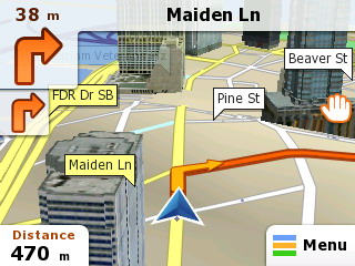
iGO 8 remains at the forefront of GPS navigation engines. First introduced in 2008, iGO 8 has undergone continuous refinement and remains the gold standard in 3D navigation that does not require expensive hardware to achieve peak performance.

Main features
The fastest map rendering
Online map update services
Low hardware requirements
Support of various platforms
Customizable user interface
Wide range of features
Extensive content portfolio.

Detailed features
The fastest map rendering
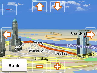
iGO 8 offers the fastest map rendering on any platform with eye catching 3D map view
 Online map update services
Online map update services available - easy updating and extra content downloading at www.naviextras.com
 Customizable user interface
Transparent, user-friendly, customizable user interface
 Wide range of features
Wide range of features implemented for advanced navigation products
 Low hardware requirements
Low hardware requirements, optimized performance
 Extensive content portfolio
An extensive content portfolio is available from providers, together with numerous connected services
 Support of various platforms
Support of various platforms and compatibility with wide range of GPS devices (PNDs, smartphones, automotive, even for non-touch (iDrive type) remote controlled products)

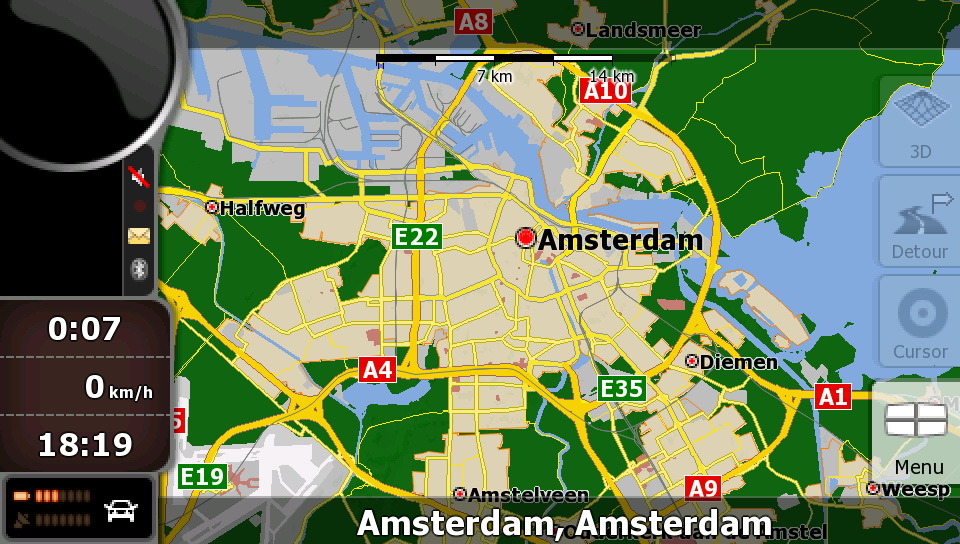
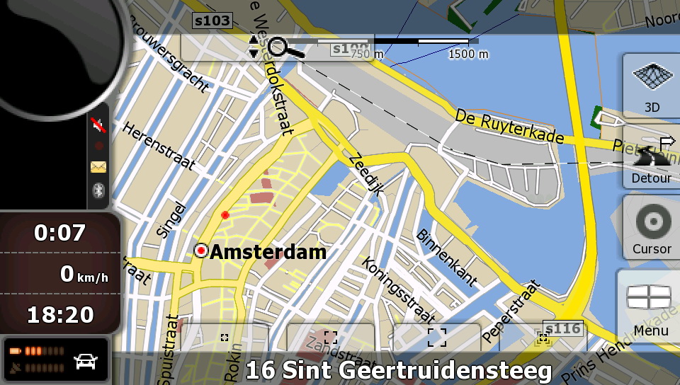
NavNGo_iGO8_Amsterdam

NavNGo_iGO8_Amsterdam

NavNGo_iGO8_Amsterdam

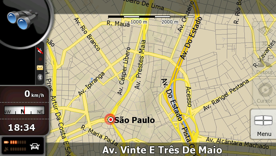
NavNGo_iGO8_Brasil

NavNGo_iGO8_Brasil

NavNGo_iGO8_Brasil

NavNGo_iGO8_Munich

NavNGo_iGO8_Munich

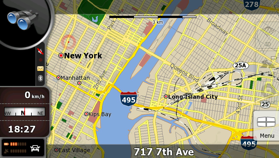
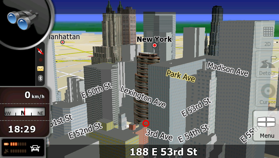
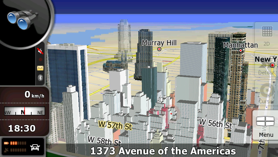
NavNGo_iGO8_NY

NavNGo_iGO8_NY

NavNGo_iGO8_NY

NavNGo_iGO8_NY


Download iGO 8 Map Updates and Extras

How it works
Connect your device or the SD card to your computer
Go to www.naviextras.com
Create a free user account
Download Naviextras Toolbox, a free PC-tool, that connects your device to the PC and automatically scans for installed software and maps
Pick your map or content package and proceed to payment
Follow the prompts to install your latest maps… and you’re ready to hit the road!


Keywords: GPS Maps, GPS Software, Tutorial, Tutorials,  Download, Downloads, NEWS,iGO 8.


iGO amigo

Navigation made easy
iGO amigo is an easy to use, simple to learn navigation software. The software contains all essential navigation functions on a fresh, user-friendly interface. All this is built on a rock solid foundation.


Main features
Rapid device porting
Customized content sets
Differentiated skins
Economical memory usage
Latest Map Guarantee
Supporting all major operating systems.

Detailed features
Rapid device porting
Turnkey or customized software solutions, experienced in rapid device porting which reduces the time-to-market period significantly.
 Economical memory usage
Economical memory usage provides high performance even on low-end navigation devices.
 Customized content sets
Customized content sets and transparent licensing policy make content integration extremely fast and simple.
 Differentiated skins
A number of innovative and differentiated skins are available on an exclusive basis
 Supporting all major operating systems
Supporting all major operating systems such as Windows CE, Android, iPhone and more
 Latest Map Guarantee
Latest Map Guarantee eliminates any worries about out-of-date stock by guaranteeing a one-time free map update from Naviextras.com after purchasing the device
 Global map coverage
We offer maps for 70 countries, including full Europe, North America, and certain countries of South America; and we are continuously expanding our map portfolio.
 Local language support
iGO amigo voice guidance is available in 43 languages, which also means that if you want to keep your eyes firmly on the road, you can rely entirely on the voice guidance while driving.
 Proven Engine
Built on our iGO Navigation engine which has already proven its abilities and reliability in iGO primo and iGO Classic navigation software platforms, iGO amigo differs from these in its construction and appearance.
 Route overview
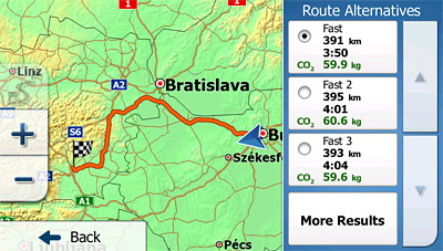
The overview presents the route variants (fast, short, economical, and easy-to-follow) and their most important properties on a top-down map, and gives users freedom of choice.
 Smart Keyboard
The smart keyboard speeds up the process of entering city and street names by offering the most likely matching choices based on previously used destinations and on city population sizes. The smart history 'learns' the user's behavior and habits: It offers a ranked list with the most likely destinations based on the current GPS position and previous routes.
 Further sophisticated route calculation
iGO amigo calculates not only fast, short, and economical route variants, but also easy-to-follow routes, which include fewer and simpler maneuvers, using main roads where possible.
 'Where am I?'
iGO amigo's 'Where am I?' function helps users in emergency situations: This function specifies the current GPS position, and helps in locating nearby assistance, such as a police station, ambulance, break-down service, etc.
 Integrated tutorial
iGO amigo comes with a brief integrated tutorial slide-show which explains all the important features to first time users who have never tried GPS navigation before.
 Vehimarkers
With iGO amigo, users can select different images for their position markers, so the traditional arrow may be changed to a variety of realistic 3D symbols, including pedestrian, bicycle and numerous models of cars.

iGO_amigo_screenshot

iGO_amigo_screenshot

iGO_amigo_screenshot

iGO_amigo_screenshot

iGO_amigo_screenshot

iGO_amigo_screenshot

iGO_amigo_screenshot

iGO_amigo_screenshot

iGO_amigo_screenshot


Download iGO Amigo Map Updates and Extras

How it works
Connect your device or the SD card to your computer
Go to www.naviextras.com
Create a free user account
Download Naviextras Toolbox, a free PC-tool, that connects your device to the PC and automatically scans for installed software and maps
Pick your map or content package and proceed to payment
Follow the prompts to install your latest maps… and you’re ready to hit the road!


Keywords: GPS Maps, GPS Software, Tutorial, Tutorials,  Download, Downloads, NEWS,iGO amigo.


Friday, March 30, 2012

iGO primo


Simply Advanced Navigation
iGO primo®, the flagship OEM product in the iGO Navigation range combines simplicity of use with the most recent technological advances in features and functionality.

Main Features
State-of-the-art intuitive UI
Truck features
Latest Map Guarantee
Connected features
Intuitive features
Fleet and mobile resource management
HD 3D Visual Experience

Detailed Features
Intuitive features
  • Congestion detour
  • Real-time route alternatives
  • Hints upon detour
  • Parking around destination

Visualization
  • High Definition Terrain Visualization
  • Additional Visualization Highlights
  • Breadcrumb Trail

Destination search
  • Smart Keyboard
  • Smart History
  • Point Addressing
  • Picture Navigation
  • Additional Search Highlights

Routing
  • Historical speed
  • Green Routing
  • Time Sense
  • Quick Planning
  • Real route alternatives
  • Additional Routing Highlights

Guidance
  • Real Junctions
  • Tunnel view
  • Lane Guidance and Real Signposts
  • Driver Alerts
  • Proximity Alerts
  • Additional Guidance Highlights
  • Support for 4WD routing (Australia)
  • Voice Guidance
  • TTS Pro

Traffic
  • Visualization of the direction of traffic events
  • Traffic

User interface and workflow
  • Design objectives
  • User-configurable 
  • Convenience Features

Additional features
  • Driver profiles
  • Outdoor Features
  • Application suite
  • Localization

  • Truck Navigation
  • SLAPI 1.2 for fleet management
  • User Speedcams
  • Branding and customization
  • Miscellaneous Application Features
iGO primo new

iGO primo Green Routing

iGO primo Driver Alerts

iGO primo Country Info

iGO primo Main menu

iGO primo Quick Planning

iGO primo Real Signpost

iGO primo Route Alternatives

iGO primo Route Variants

iGO primo Terrain Visualization

iGO primo Terrain Visualization

iGO primo Track log with Speed Profile

iGO primo Traffic

iGO primo Traffic

iGO primo Trip Real Junctions

iGO primo Truck Settings

iGO primo Truck Settings


Download iGO Primo Map Updates and Extras

How it works
Connect your device or the SD card to your computer
Create a free user account
Download Naviextras Toolbox, a free PC-tool, that connects your device to the PC and automatically scans for installed software and maps
Pick your map or content package and proceed to payment
Follow the prompts to install your latest maps… and you’re ready to hit the road!


Keywords: GPS Maps, GPS Software, Tutorial, Tutorials,  Download, Downloads, NEWS,iGO primo, video, Video Tutorial.


iGO primo app

iGO My way for iPhone
Your complete 3D navigation for iPhone
Powered by the same experienced iGO Engine used in millions of navigation devices around the world: now faster & more reliable than ever before, with a set of new features for even more intelligent navigation.

Main Features
Google local search
Green routing
Extras through in-app purchase
Free traffic (only in Western European countries)
Navigation to coordinates
TTS Pro (advanced speech)
Realistic, 3D Junctions

Detailed features
Stunning 3D visualization
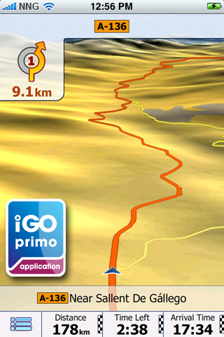
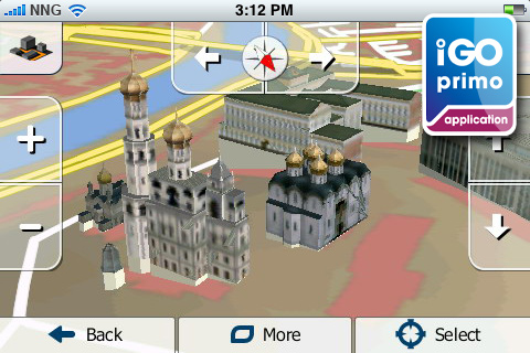
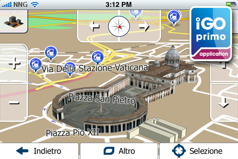
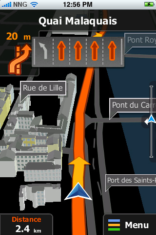
iGO primo app offers stunning 3D visualization. Complex junctions are displayed in 3D to provide a rapid understanding of your next maneuver while true-to-life 3D models of famous landmarks and display of the terrain around you - such as valleys, hills and mountains.

 TTS Pro
The Text-to-Speech (TTS) feature allows pronouncing city, street and highway names as part of the guidance instructions. The new TTS Pro reads out not only standard voice commands, but also traffic events, a summary of the planned route and relevant country info after crossing a border. Text-to-Speech is available in the following languages: English, French, German, Italian, Spanish, Portuguese, Russian. Note: The languages mentioned above vary in the applicable packagages.

 Google local search
Find businesses or anything else you need around your position

 In-app purchase for extras
Country maps, safety cameras, Rich POIs (Explorer’s package), Live Traffic: Save time by using the alternative routes generated automatically by your navigation software following the up-to-date traffic information available for your present route.

 Free Live Traffic
Our Europe, Western Europe, Italy, France, Scandinavia, Benelux, Brazil, North America lite, North America, Russia and DACH applications come now with FREE LIVE TRAFFIC information! Save time by using the alternative routes generated automatically by your navigation software following the up-to-date traffic information available for your present route!

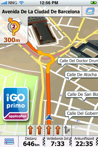
 Realistic Junction View
Realistic images of motorway junctions for easier orientation.

 Sophisticated route calculation
iGO primo app calculates not only fast, short, and easy-to-follow routes, but also green ones. The green routing option is new, choose this one for lower fuel consumption and CO2 emission.

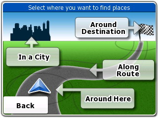
 POI search along the route

 Multiple Destination Entry
Navigate to: iPhone contacts, GPS-coordinates, pictures

 Customizable quick menu

 Customizable vehicle profile

 Send a question to Customer Support

 Optimized in-car use
Extra large buttons, simple icons, and a truly intuitive interface with streamlined workflow ensure optimized in-car use and maximum attention to the road.

 Precise voice guidance in numerous language
iGO primo app supports numerous languages. Please check out the description of the individual packages for the list of the languages included.

 QWERTY keyboard
Use the QWERTY keyboard layout with extra large keys in landscape mode to enter an address.

 Supporting multi-point routes
You can now add one intermediate destination to your route. This feature was introduced in version 1.1.

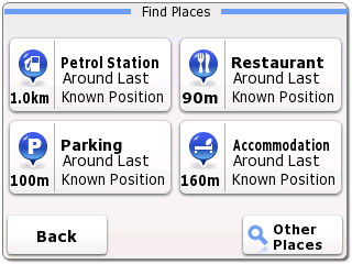
 Calling POIs (Places)
If you find a Point of Interest (POI) that has a phone number, you can call it immediately from the navigation application.

 Quickstart function
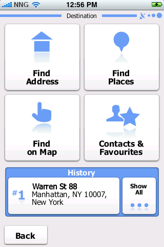
No need to remember road names and house numbers. Save an unlimited number of favorites for a quickstart.

 Smart history
The smart history 'learns' the user's behavior and habits, and offers a ranked list with the most likely destinations based on the current GPS position, previous routes, day of the week, and time of day.

 Where am I? - emergency function
Find help in emergency situations! Based on the current GPS position this function diplays nearby assistance, such as police stations, break-down services, ATMs, etc.

 Millions of POIs
Select from millions of Points of Interest along your route or at your destination, and you can easily find nearby hotels, restaurants, ATMs, gas stations, etc.

 Multi-touch screen
You can zoom the map in and out with two fingers - in iPhone style - but for quicker control one-touch operation is also supported.

 Smart Keyboard
The Smart Keyboard speeds up the address entry by completing the most likely city and street names.

 Explore the map
You can freely browse and explore the map in both 2D and 3D mode: zoom, drag, tilt, rotate, and select any point on the map as destination.

 Auto orientation
To make navigation on iPhone really handy, the application selects automatically between portrait and landscape format.

 Lane assistance and realistic signposts
iGO primo app makes navigation easy even in complex situations. Country-specific lane guidance and signposts give you even more realistic help in choosing the right lane well before the upcoming maneuvres.

 Day and Night mode
With changing light conditions when driving into tunnels or at dawn, iGO primo app switches between Day and Night mode.

 Vehimarkers
With iGO primo app, users can select different images for their position markers, so the traditional arrow can be changed to a variety of realistic 3D symbols, including pedestrian, bicycle and numerous car models.

 Navigation resumes after incoming call
Following an incoming call during navigation, iGO primo app simply resumes guidance without any user interaction.

How does it work?

Upgrade to the brand new iGO primo app now!*
Easy to learn – this app is ideal even for people who have never tried GPS navigation before. The maps are part of the application**, for navigation you don’t need cellular network coverage. NO ROAMING FEES, no surprises.

Getting there – easier and faster
Select your destination — either by searching for an address, a place of interest, or by picking a spot on the map. Our Smart keyboard and Smart search make it easy. Our Adaptive Search Results technology actually learns from your use of the application and tailors search results accordingly.

iGO primo app calculates the route to your chosen destination and displays a map overview along with the most important information, such as journey distance and estimated travel time. Just tap Go! and iGO primo app guides you to your destination with clear voice guidance and a smoothly moving 3D map. Lane assistance and signposts are now country-specific and therefore even more realistic to help you find your way no matter where you go.

Apart from fast, short and easy-to-follow route variants, you can now also use our new Green routing option, for lower fuel consumption and CO2 emission. The route variants are calculated and displayed simultaneously, so you can compare the alternatives visually on the map and pick the one that suits your needs best. You can avoid freeways, ferries, unpaved roads, and toll roads, and the new Avoidances option lets you bypass any road section of the itinerary. You don’t have to worry even if you miss a turn: iGO primo app instantly re-calculates the route.

Installation and setup
Please note that since iPod touch and iPad do not have built-in GPS-receivers, an external GPS-receiver is required. Compatible are only those which are officially supported by Apple. Due to the size of the package, we recommend purchasing and downloading the application via iTunes.

Note: Continuous use of GPS running in the background can dramatically decrease battery life. Background navigation has to be turned on – you can do this under Settings / Advanced settings.

* This update is not available for iPhone 3G devices.
** NNG will make the latest maps available as part of the free software updates, depending on availability. Conditions apply.


Screenshots

iGO primo app for iPhone


iGO primo app for iPhone


iGO primo app for iPhone


iGO primo app for iPhone


iGO primo app for iPhone


iGO primo app for iPhone


iGO primo app for iPhone


iGO primo app for iPhone


iGO primo app for iPhone


iGO primo app for iPhone


iGO primo app for iPhone


iGO primo app for iPhone


iGO primo app for iPhone


iGO primo app for iPhone


iGO primo app for iPhone


iGO primo app for iPhone


iGO primo app for iPhone


iGO primo app for iPhone


iGO primo app for iPhone


Videos

iGO primo app - Your journey starts here


iGO primo app for iPhone sneak peek


Navigate with iGO My way for iPhone


iGO My way for iPhone


iGO primo app all regions

North America Edition
USA + Canada in 4 languages.
Europe Edition
40 European countries in 29 languages.
Western Europe Edition
22 Western European countries in 13 languages.
Eastern Europe Edition
20 Eastern European countries in 17 languages.
Eastern Europe Region Edition
6 Eastern European countries in 17 languages.
UK and Ireland Edition
UK and Ireland in 13 languages.
Scandinavia Edition
4 Scandinavian countries in 9 languages.
France Edition
France in 7 languages
Italy Edition
Italy in 5 languages
Benelux Edition
Benelux in 13 languages.
DACH Edition
DACH in 13 languages.
Iberia Edition
Iberia in 13 languages.
Czech Republic and Slovakia
Czech Republic and Slovakia in 17 languages
Hungary and Romania Edition
Hungary and Romania in 17 languages.
Southern Africa Edition
6 African countries
India Edition
India in 7 languages
Russia Edition
Russia in 17 languages.
Israel Edition
Israel in 29 languages.
Middle East Edition
7 countries of Middle East in 6 languages.
Costa Rica Edition
Costa Rica in 5 language.
Chile Edition
Chile in 7 languages.
Colombia Edition
Colombia in 7 languages.
Argentina Edition
Argentina in 7 languages.
Brazil Edition
Brazil in 7 languages.
Australia and New Zealand Edition
Australia + New Zealand in 11 languages.
Turkey Edition
Turkey in 19 languages.

Download


Keywords: GPS Maps, GPS Software, Tutorial, Tutorials, Video Tutorials, Download, Downloads, video,NEWS,iGO primo app,iPhone.