Showing posts with label GPS Software. Show all posts

Saturday, August 10, 2013

TomTom Europe v1.2 - Android - 2013

TomTom Navigation for Android. World-class navigation that’s trusted by 70 million drivers.
Last minute plans? With the TomTom Navigation app, driving somewhere new couldn’t be easier. You’ve always got your smartphone with you, so navigation’s close at hand. And losing signal is not a problem, because the app works not only online, but offline too. This saves you money on data roaming costs, and, you’ll have constant access to the same maps, technology and world-class navigation as on our satnavs. It’s the app that drivers can rely on.

Only the TomTom Navigation app offers all this:

- TomTom Offline Maps. Maps are stored on your smartphone – so you can plan a new route, get re-routed, or search for points of interest. Without needing data coverage.

- FREE Lifetime Maps. Always drive with the latest map and get to your destination faster. Download 4 or more full updates every year for the life of your app.

- IQ Routes. The fastest routes, the most accurate and reliable arrival times at all times of day.

- HD Traffic. Faster. Proven. (available via in-app purchase)(1)

- Speed Cameras. Fewer speeding fines with real-time camera alerts. (available via in-app purchase)(1)

- TomTom Places. Search results designed for drivers.

- Multitasking support. Clear turn-by-turn guidance while on the phone.

- Seamless Integration. Integrates easily with your Android smartphone contacts.

- Advanced Lane Guidance. Gives you extra clarity when navigating difficult junctions. Merge, exit and change lanes with confidence.

- Spoken Street Names. Helping you to keep your eyes on the road, spoken instructions now include street names, to make turnings even clearer.

Other features:
- Landscape/portrait orientation option
- 2D/3D driving view
- Automatic day & night mode
- Clear voice instructions
- Automatic music fading
- Fast route recalculation
- Multi-stop routes
- Eco Routes
- Millions of pre-installed POIs
- Stream voice instructions to the TomTom Hands-free car kit
- Car symbols
- Map colours
- See http://www.tomtom.com/navigation/android for full feature descriptions

*** MAPS COVERAGE ***
- AD, AT, BE, CH, CZ, DE, DK, EE, ES, FI, FR, GB, GR, HR, HU, IC, IE, IT, LI, LT, LU, LV, MC, MT, NL, NO, PL, PT, SE, SI, SK, SM, TR, VA, BG (58%), CY (52%), RU (51%), UA (42%), RO (16%)
- See http://goo.gl/xCJWT for country abbreviations

*** BEFORE YOU BUY THIS APP ***
1. Check that you have at least 3.4Gb of free storage space, either on your internal phone memory or external storage. To look it up, go to your phone settings, and then data storage.
2. If there’s enough storage, buy the app using your Google account and install it on your phone. You now need to download the latest TomTom map before you can use the app.
3. Connect your phone via Wifi to the internet and open up the app. You will then be able to download your new map. This download may take up to two hours depending on your internet connection. Connect your phone to a charger and stay in range of your WiFi network until the download is complete.


*** MORE INFORMATION ***
(1) Check http://android.tomtom.com for availability per country. Services are available via in-app purchase and require a mobile phone connection. Your operator may charge you for the data used and costs may be significantly higher when used abroad. Services can only be used on one device at the same time. If you want to use your subscription on a different device, login with your MyTomTom account in the TomTom Shop on your preferred device.
(2) Spoken street names comes in the following languages: Spanish, Slovak, Russian, Portuguese, Polish, Norwegian, Italian, Indian English, Hungarian, Greek, German, French, Flemish, Finnish, Dutch, Danish, Czech, British English, Turkish, Swedish

Download TomTom Europe v1.2 - Android


Tags: Android, Android App, Download, Downloads, GPS Maps, GPS Software, Navigation Software,TomTom Europe v1.2,TomTom Europe 2013,TomTom Europe Android 2013,TomTom Europe v1.2 Maps,TomTom Europe v1.2 - Android [910.4892],TomTom Europe Maps 2013.


Tuesday, July 16, 2013

Garmin City Navigator® North America NT 2014.10

Navigate the streets with confidence. This product provides detailed road maps and points of interest for your device, so you can navigate with exact, turn-by-turn directions to any address or intersection.

Displays more than 10 million points of interest, including hotels, restaurants, parking, entertainment, fuel and shopping.
Includes postal code support for Canada.
Gives turn-by-turn directions on compatible devices.
Speaks street names (example: "Turn right on Main Street").
Includes navigational features, such as turn restrictions, roundabout guidance and speed categories.
Contains traffic data for compatible devices with traffic receivers.
(DVD version only) Includes Trip-Planning software to plan trips on your computer and transfer waypoints, routes and tracks to your device.

Coverage
Features highways, interstates, and business and residential roads in metropolitan and rural areas in the U.S. and outlaying areas, specifically:

Canada
Mexico
Puerto Rico
U.S. Virgin Islands
Cayman Islands
The Bahamas
French Guiana
Guadeloupe
Martinique
Saint Barthélemy
Jamaica

Garmin City Navigator® North America NT 2014.10


Download Garmin City Navigator® North America NT 2014.10


Keywords: Downloads, GPS Maps,GPS Software, NEWS,Tutorial, Tutorials,MapSource,Download, City Navigator® North America NT 2014.10.


Garmin City Navigator® Europe NT 2014.10

Navigate the streets with confidence. This product provides detailed road maps and points of interest for your device, so you can navigate with exact, turn-by-turn directions to any address or intersection.

Note: This is not a map update. To update the existing maps on your device, check for map updates.
•Includes more than 10.4 million km (6.5 million mi) of roads, including motorways, national and regional thoroughfares and local roads, in Western Europe and many countries in Eastern Europe.
•Displays more than 6 million points of interest throughout the region, including restaurants, lodging, border crossings, attractions, petrol stations, campsites and shopping.
•Gives turn-by-turn directions on compatible devices.
•Enhances pronunciation for compatible devices that speak street names (example: "Turn right on Main Street").
•Includes navigational features, such as turn restrictions, roundabout guidance and speed categories.
•Contains traffic data for compatible devices that use traffic receivers.
•(DVD only) Includes computer software that lets you plan trips on your computer and transfer waypoints, routes and tracks between your computer and your device.

Requirements
Download Requirements
File Information
The file size of this download and space required on device or microSD™/SD™ card is 2.85 GB. If this download does not fit on your device, data may be saved on a microSD/SD card (Recycled microSD cards may be used to program map data).

Please note, these full-version maps do not contain premium content such as junction view or 3-D buildings and terrain. These features only are available on the preloaded maps within your device or through a specific update for the mapping region of your device.

Use with 1 Device Only
This product may be unlocked and used on 1 compatible device. If you want to use this same map on subsequent devices, you must purchase a new map for each device.

Data downloaded to a microSD/SD card is associated with the device you select during the download process. Please purchase additional quantities for additional devices.

Product Compatibility
Make sure your device is compatible with this product before purchasing. Downloadable products are non-refundable.

A card reader and microSD/SD card are required to download mapping to the following devices: eTrex® Legend Cx/HCx, Vista Cx/HCx, Venture Cx; GPSMAP® 60CSx/60Cx; GPSMAP 76CSx/76Cx; Rino® 520HCx/530HCx; Astro® 220; StreetPilot® 7200/7500 (not all devices are compatible with all downloads).

Download Times
Not for use with dial-up Internet access or satellite Internet providers. Actual download speeds may vary.

Expiration Date
You have 1 year from the date of purchase to download this file.

Minimum Requirements
The download process requires you to install the free Garmin Communicator Plugin on your computer so we can communicate with your device. Note: The download is installed directly to your device or microSD/SD card and is not accessible on the computer.
Windows®
•Windows XP SP3 or newer
•1 GB RAM
•1024 x 768 display
•USB port
•4 GB free disk space
•Microsoft .NET Framework 4 Client Profile (included)
•High speed Internet access
Mac®
•Any Intel-based Mac
•OS X 10.5.8 or later
•1 GB RAM
•1024 x 768 display
•USB port
•4 GB free disk space
•High speed Internet access


MicroSD™/SD™ card Requirements
Make sure your device is compatible with this product before purchasing.

To view and use the maps on this card, you must have a device with a microSD or SD card slot. Maps on microSD/SD cards cannot be copied or viewed on a computer.

Reduced price map updates are not available for these cards. If you want to update the maps, you must purchase a new card that includes the latest map data.

The microSD/SD card package includes a microSD card and an SD card adapter.

DVD Requirements
Make sure your device is compatible with this product before purchasing.

This product may be unlocked and used on 1 compatible device. If you want to use this same map on subsequent devices, you must purchase a new map for each device.

You cannot use this product to update the maps on your preloaded device. To order updated map data for your preloaded device, visit our Update Maps page.

Before you can download map detail to a memory card or directly to your compatible device, you must unlock this disk (simply follow the instructions on the certificate that comes in the packaging).

Minimum System Requirements
Internet access is required. Includes USB device drivers.
Windows®
•Windows XP SP3 or newer
•1 GB RAM
•At least 1024 x 768 display
•24-bit color monitor
•4 GB free disk space
•USB port
•DVD drive
•Microsoft .NET Framework 4 Client Profile (included)
Mac®
•Any Intel-based Mac
•1 GB RAM
•OS X 10.5.8 or later
•1024 x 768 display
•4 GB free disk space
•USB port
•DVD drive

Coverage
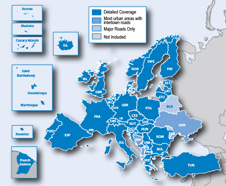
Features full coverage for Romania, Guadeloupe, Martinique, St. Barthélemy and French Guiana, and increased detailed coverage for Bosnia and Herzegovina. Also includes Western Europe and many countries in Eastern Europe, specifically:

Great Britain and Republic of Ireland
•Great Britain: Full coverage
•Scotland: Full coverage
•Wales: Full coverage
•Isle of Man: Full coverage
•Northern Ireland: Full coverage
•Ireland: Full coverage
•Channel Islands: Full coverage

Denmark, Finland, Iceland, Norway, and Sweden
•Denmark: Full coverage
•Finland: Full coverage
•Iceland: Full coverage
•Norway: Full coverage
•Sweden: Full coverage

France and Benelux
• Andorra: Full coverage
• Belgium: Full coverage
• France: Full coverage
• French Guiana: Coverage for most urban areas
• Guadeloupe: Full coverage
• Martinique: Full coverage
• Netherlands: Full coverage
• Luxembourg: Full coverage
• Réunion: Coverage for most urban areas
• Saint Barthélemy: Full Coverage

Italy, Austria, Switzerland, and Liechtenstein
• Italy: Full coverage
• Austria: Full coverage
• Switzerland: Full coverage
• Liechtenstein: Full coverage

Malta
• Malta: Full coverage

Spain and Portugal
• Spain: Full coverage
• Portugal: Full coverage
•Gibraltar: Full coverage
• Azores Islands: Full coverage
• Canary Islands: Full coverage
•Baleric Islands: Full coverage
•Madeira: Full coverage

Germany
• Germany: Full coverage

Czech Republic
•Czech Republic: Full coverage

Greece
•Greece: Full coverage

Eastern Europe
•Estonia: Full coverage
•Latvia: Full coverage
• Lithuania: Full coverage
• Poland: Full coverage
• Slovakia: Full coverage
• Hungary: Full coverage
• Slovenia: Full coverage
• Croatia: Full coverage
• Bulgaria: Full coverage
•Romania: Full coverage
•Turkey: Full coverage
•Moldova: Major roads only
•Bosnia & Herzegovina: Coverage for most urban areas
•Serbia & Kosovo: Full Coverage
•Montenegro: Coverage for most urban areas
•Albania: Major roads only
•Republic of Macedonia (FYROM): Full coverage
•Belarus: Major roads only
•Ukraine: Coverage for most urban areas

Garmin City Navigator® Europe NT 2014.10

Compatible Devices
Compatible with Disk Version
aera® 500
aera® 510
aera® 550
aera® 560
Alpha™
Astro®
Astro® 220
Colorado® 300
Colorado® 400c
Colorado® 400i
Colorado® 400t
Dakota® 10
Dakota® 20
dÄ“zl™ 560LMT
dÄ“zl™ 560LT
dÄ“zl™ 760LMT
Edge® 605
Edge® 705
Edge® 800
Edge® 810
eTrex® 20
eTrex® 30
eTrex Legend® Cx
eTrex Legend® H
eTrex Legend® HCx
eTrex Summit® HC
eTrex Venture® Cx
eTrex Venture® HC
eTrex Vista® Cx
eTrex Vista® H
eTrex Vista® HCx
GPSMAP® 276C
GPSMAP® 278
GPSMAP® 296
GPSMAP® 376C
GPSMAP® 378
GPSMAP® 396
GPSMAP® 478
GPSMAP® 495
GPSMAP® 496
GPSMAP® 60CSx
GPSMAP® 60Cx
GPSMAP® 62
GPSMAP® 620
GPSMAP® 62s
GPSMAP® 62sc
GPSMAP® 62st
GPSMAP® 62stc
GPSMAP® 640
GPSMAP® 76CSx
GPSMAP® 76Cx
GPSMAP® 78
GPSMAP® 78s
GPSMAP® 78sc
iQue® 3000
iQue® M3
iQue® M4
Montana® 600
Montana® 600t Camo
Montana® 650
Montana® 650t
Monterra™
nüLink!® 1690 LIVE
nüLink!® 1695 LIVE
nüvi® 1100
nüvi® 1100LM
nüvi® 1200
nüvi® 1250
nüvi® 1260T
nüvi® 1300
nüvi® 1300LM
nüvi® 1350
nüvi® 1350LMT
nüvi® 1350T
nüvi® 1360
nüvi® 1370T
nüvi® 1390LMT
nüvi® 1390T
nüvi® 1450
nüvi® 1450LM
nüvi® 1450LMT
nüvi® 1450T
nüvi® 1490LMT
nüvi® 1490T
nüvi® 200
nüvi® 200W
nüvi® 205
nüvi® 205W
nüvi® 2200
nüvi® 2250
nüvi® 2250LT
nüvi® 2300
nüvi® 2300LM
nüvi® 2350
nüvi® 2350LMT
nüvi® 2350LT
nüvi® 2360LMT
nüvi® 2360LT
nüvi® 2370LT
nüvi® 2450
nüvi® 2450LM
nüvi® 2455LMT
nüvi® 2455LT
nüvi® 2457LMT
nüvi® 2460LMT
nüvi® 2460LT
nüvi® 2475LT
nüvi® 2495LMT
nüvi® 2497LMT
nüvi® 250
nüvi® 250W
nüvi® 255
nüvi® 2555LM
nüvi® 2555LMT
nüvi® 2555LT
nüvi® 2557LMT
nüvi® 255W
nüvi® 2577LT
nüvi® 2595LMT
nüvi® 2597LMT
nüvi® 260
nüvi® 260W
nüvi® 265T
nüvi® 265WT
nüvi® 270
nüvi® 2757LM
nüvi® 275T
nüvi® 2797LMT
nüvi® 285WT
nüvi® 295W
nüvi® 30
nüvi® 3450
nüvi® 3450LM
nüvi® 3490LMT
nüvi® 3550LM
nüvi® 3590LMT
nüvi® 3597LMTHD
nüvi® 3750
nüvi® 3760LMT
nüvi® 3760T
nüvi® 3790LMT
nüvi® 3790T
nüvi® 40
nüvi® 40LM
nüvi® 42
nüvi® 44
nüvi® 44LM
nüvi® 465LMT
nüvi® 50
nüvi® 500
nüvi® 50LM
nüvi® 52
nüvi® 52LM
nüvi® 54
nüvi® 54LM
nüvi® 550
nüvi® 750
nüvi® 755T
nüvi® 760
nüvi® 765T
nüvi® 770
nüvi® 775T
nüvi® 780
nüvi® 785T
nüvi® 850
nüvi® 855
nüvi® 880
nüvi® 885T
nüvifone™ G60
Oregon® 200
Oregon® 300
Oregon® 400c
Oregon® 400i
Oregon® 400t
Oregon® 450
Oregon® 450t
Oregon® 550
Oregon® 550t
Oregon® 600
Oregon® 600t
Oregon® 650
Oregon® 650t
Quest® 2
Rino® 520HCx
Rino® 530HCx
Rino® 610
Rino® 650
Rino® 655t
StreetPilot® 2720
StreetPilot® 2730
StreetPilot® 2820
StreetPilot® 7200
StreetPilot® 7500
zÅ«mo® 220
zÅ«mo® 350LM
zÅ«mo® 450
zÅ«mo® 550
zÅ«mo® 660
zÅ«mo® 660LM
zÅ«mo® 665
zÅ«mo® 665LM

Compatible with Download Version
aera® 500
aera® 510
aera® 550
aera® 560
Alpha™
Astro®
Astro® 220
Colorado® 300
Colorado® 400c
Colorado® 400i
Colorado® 400t
Dakota® 10
Dakota® 20
dÄ“zl™ 560LMT
dÄ“zl™ 560LT
dÄ“zl™ 760LMT
Edge® 605
Edge® 705
Edge® 800
Edge® 810
eTrex® 20
eTrex® 30
eTrex Legend® Cx
eTrex Legend® HCx
eTrex Venture® Cx
eTrex Vista® Cx
eTrex Vista® HCx
GPSMAP® 60CSx
GPSMAP® 60Cx
GPSMAP® 62
GPSMAP® 620
GPSMAP® 62s
GPSMAP® 62sc
GPSMAP® 62st
GPSMAP® 62stc
GPSMAP® 640
GPSMAP® 76CSx
GPSMAP® 76Cx
GPSMAP® 78
GPSMAP® 78s
GPSMAP® 78sc
Montana® 600
Montana® 600t Camo
Montana® 650
Montana® 650t
Monterra™
nüLink!® 1690 LIVE
nüLink!® 1695 LIVE
nüvi® 1100
nüvi® 1100LM
nüvi® 1200
nüvi® 1250
nüvi® 1260T
nüvi® 1300
nüvi® 1300LM
nüvi® 1350
nüvi® 1350LMT
nüvi® 1350T
nüvi® 1360
nüvi® 1370T
nüvi® 1390LMT
nüvi® 1390T
nüvi® 1450
nüvi® 1450LM
nüvi® 1450LMT
nüvi® 1450T
nüvi® 1490LMT
nüvi® 1490T
nüvi® 200
nüvi® 200W
nüvi® 205
nüvi® 205W
nüvi® 2200
nüvi® 2250
nüvi® 2250LT
nüvi® 2300
nüvi® 2300LM
nüvi® 2350
nüvi® 2350LMT
nüvi® 2350LT
nüvi® 2360LMT
nüvi® 2360LT
nüvi® 2370LT
nüvi® 2450
nüvi® 2450LM
nüvi® 2455LMT
nüvi® 2455LT
nüvi® 2457LMT
nüvi® 2460LMT
nüvi® 2460LT
nüvi® 2475LT
nüvi® 2495LMT
nüvi® 2497LMT
nüvi® 250
nüvi® 250W
nüvi® 255
nüvi® 2555LM
nüvi® 2555LMT
nüvi® 2555LT
nüvi® 2557LMT
nüvi® 255W
nüvi® 2577LT
nüvi® 2595LMT
nüvi® 2597LMT
nüvi® 260
nüvi® 260W
nüvi® 265T
nüvi® 265WT
nüvi® 270
nüvi® 2757LM
nüvi® 275T
nüvi® 2797LMT
nüvi® 285WT
nüvi® 295W
nüvi® 30
nüvi® 3450
nüvi® 3450LM
nüvi® 3490LMT
nüvi® 3550LM
nüvi® 3590LMT
nüvi® 3597LMTHD
nüvi® 3750
nüvi® 3760LMT
nüvi® 3760T
nüvi® 3790LMT
nüvi® 3790T
nüvi® 40
nüvi® 40LM
nüvi® 42
nüvi® 42LM
nüvi® 44
nüvi® 44LM
nüvi® 465LMT
nüvi® 50
nüvi® 500
nüvi® 50LM
nüvi® 52
nüvi® 52LM
nüvi® 54
nüvi® 54LM
nüvi® 550
nüvi® 750
nüvi® 755T
nüvi® 760
nüvi® 765T
nüvi® 770
nüvi® 775T
nüvi® 780
nüvi® 785T
nüvi® 850
nüvi® 855
nüvi® 880
nüvi® 885T
nüvifone™ G60
Oregon® 200
Oregon® 300
Oregon® 400c
Oregon® 400i
Oregon® 400t
Oregon® 450
Oregon® 450t
Oregon® 550
Oregon® 550t
Oregon® 600
Oregon® 600t
Oregon® 650
Oregon® 650t
Rino® 520HCx
Rino® 530HCx
Rino® 610
Rino® 650
Rino® 655t
StreetPilot® 7200
StreetPilot® 7500
zÅ«mo® 220
zÅ«mo® 350LM
zÅ«mo® 450
zÅ«mo® 550
zÅ«mo® 660
zÅ«mo® 660LM
zÅ«mo® 665
zÅ«mo® 665LM

Compatible with microSD™/SD™ Card
aera® 500
aera® 510
aera® 550
aera® 560
aera® 795
aera® 796
Alpha™
Astro®
Astro® 220
Colorado® 300
Colorado® 400c
Colorado® 400i
Colorado® 400t
Dakota® 20
dÄ“zl™ 560LMT
dÄ“zl™ 560LT
dÄ“zl™ 760LMT
Edge® 605
Edge® 705
Edge® 800
Edge® 810
eTrex® 20
eTrex® 30
eTrex Legend® Cx
eTrex Legend® HCx
eTrex Venture® Cx
eTrex Vista® Cx
eTrex Vista® HCx
GPSMAP® 60CSx
GPSMAP® 60Cx
GPSMAP® 620
GPSMAP® 62s
GPSMAP® 62sc
GPSMAP® 62st
GPSMAP® 62stc
GPSMAP® 640
GPSMAP® 76CSx
GPSMAP® 76Cx
GPSMAP® 78
GPSMAP® 78s
GPSMAP® 78sc
GVN 52
GVN 53
iQue® M4
Montana® 600
Montana® 600t Camo
Montana® 650
Montana® 650t
Monterra™
nüLink!® 1690 LIVE
nüLink!® 1695 LIVE
nüvi® 1100
nüvi® 1100LM
nüvi® 1200
nüvi® 1250
nüvi® 1260T
nüvi® 1300
nüvi® 1300LM
nüvi® 1350
nüvi® 1350LMT
nüvi® 1350T
nüvi® 1360
nüvi® 1370T
nüvi® 1390LMT
nüvi® 1390T
nüvi® 1450
nüvi® 1450LM
nüvi® 1450LMT
nüvi® 1450T
nüvi® 1490LMT
nüvi® 1490T
nüvi® 200
nüvi® 200W
nüvi® 205
nüvi® 205W
nüvi® 2200
nüvi® 2250
nüvi® 2250LT
nüvi® 2300
nüvi® 2300LM
nüvi® 2350
nüvi® 2350LMT
nüvi® 2350LT
nüvi® 2360LMT
nüvi® 2360LT
nüvi® 2370LT
nüvi® 2450
nüvi® 2450LM
nüvi® 2455LMT
nüvi® 2455LT
nüvi® 2457LMT
nüvi® 2460LMT
nüvi® 2460LT
nüvi® 2475LT
nüvi® 2495LMT
nüvi® 2497LMT
nüvi® 250
nüvi® 250W
nüvi® 255
nüvi® 2555LM
nüvi® 2555LMT
nüvi® 2555LT
nüvi® 2557LMT
nüvi® 255W
nüvi® 2577LT
nüvi® 2595LMT
nüvi® 2597LMT
nüvi® 260
nüvi® 260W
nüvi® 265T
nüvi® 265WT
nüvi® 270
nüvi® 2757LM
nüvi® 275T
nüvi® 2797LMT
nüvi® 285WT
nüvi® 295W
nüvi® 30
nüvi® 3450
nüvi® 3450LM
nüvi® 3490LMT
nüvi® 3550LM
nüvi® 3590LMT
nüvi® 3597LMTHD
nüvi® 3750
nüvi® 3760LMT
nüvi® 3760T
nüvi® 3790LMT
nüvi® 3790T
nüvi® 40
nüvi® 40LM
nüvi® 42
nüvi® 42LM
nüvi® 44
nüvi® 44LM
nüvi® 465LMT
nüvi® 50
nüvi® 500
nüvi® 50LM
nüvi® 52
nüvi® 52LM
nüvi® 54
nüvi® 54LM
nüvi® 550
nüvi® 750
nüvi® 755T
nüvi® 760
nüvi® 765T
nüvi® 770
nüvi® 775T
nüvi® 780
nüvi® 785T
nüvi® 850
nüvi® 855
nüvi® 880
nüvi® 885T
nüvifone™ G60
Oregon® 200
Oregon® 300
Oregon® 400c
Oregon® 400i
Oregon® 400t
Oregon® 450
Oregon® 450t
Oregon® 550
Oregon® 550t
Oregon® 600
Oregon® 600t
Oregon® 650t
Rino® 520HCx
Rino® 530HCx
Rino® 650
Rino® 655t
StreetPilot® 7200
StreetPilot® 7500
zÅ«mo® 220
zÅ«mo® 350LM
zÅ«mo® 450
zÅ«mo® 550
zÅ«mo® 660
zÅ«mo® 660LM
zÅ«mo® 665
zÅ«mo® 665LM

Download Garmin City Navigator® Europe NT 2014.10


Keywords: Downloads, GPS Maps,GPS Software, NEWS,Tutorial, Tutorials,MapSource,Download,City Navigator® Europe NT 2014.10.


Saturday, August 18, 2012

RO.A.D.2012.40

Lansare RO.A.D.2012.40
18 august 2012,scris de Bogdan Condurăţeanu

Sheba Distribution SRL, reprezentant al firmei Garmin in Romania, are placerea sa anunte disponibilitatea noii editii a Atlasului Digital al Romaniei v4.40, RO.A.D.2012.40.

Continuand in traditia binecunoscuta deja clientilor Garmin din Romania, Atlasul Digital al Romaniei se mentine in continuare pe locul I in clasamentul hartilor de navigatie rutiera, aducand in plus fata de editia precedenta peste 17.241,53 de kilometri de drumuri, ridicand la un total de 267.261,99 km de cai de comunicatii acoperirea in teritoriu, cu acoperire imbogatita in judetele Vaslui, Iasi, Caras-Severin si Hunedoara, iar numarul de informatii de tip punct se ridica in aceasta editie la 314.941 puncte impartite in 437 de categorii.

ROAD2012.40 este singura harta de navigatie din lume care combina detalii topo cu o structura de drumuri rutabila – la nivel inclusiv de drumuri de pamant si poteci – cu adrese postale de o precizie neegalata, orase cu blocuri 3D si modele minutios realizate la constructii vechi, de patrimoniu, sau noi, definitorii pentru peisajul urban actual. Actualizarile la harta sunt constante si consistente de la o editie la alta si sunt documentate in Jurnalul Hartii, in care sunt trecute contributiile si autorii acestora, datele la care s-au efectuat precum si denumirile localitatilor si planselor afectate.

Fata de hartile comune de pe piata, Atlasul Digital al Romaniei are un grad de actualitate fara egal, in aceasta editie aflandu-se in premiera autostrada A3 intre Bucuresti si Ploiesti cu legatura de la Snagov, autostrada A2 completa, inclusiv segmentul Cernavoda-Medgidia cu legatura de la Valea Dacilor, continuarea centurii A4 si legatura la A4 din Ovidiu, pasajul subteran Stefan Guse-Oituz din Bacau, pasajul rutier suprateran din Craiova, pasajul subteran de acces la Prisma-Hornbach de pe DN1 din Balotesti, pasajul subteran de acces la Carrefour Tom din Ovidiu, podul rutier nou peste Cibin din Sibiu, strapungerea Popisteanu Cristian din Bucuresti, accesul la centrele comerciale Maritimo din Constanta si Lidl din Falticeni, legatura Coresi din Brasov precum si multe cartiere rezidentiale de data recenta (cartierul A.N.L. Henri Coanda, zonele rezidentiale FeliCity, Upground, Quadra Place, Greenfield Residence, etc. din Bucuresti, Militari Residence din Rosu, Ibiza Sol, Ibiza Golf si Oxford Gardens din Voluntari, etc.), sensuri unice si 38 (treizecisiopt) sensuri giratorii aparute intre timp.

Galeria modelelor 3D s-a imbogatit cu reprezentarea detaliata a bisericii evanghelice fortificate din Biertan. Granitele, componenta si denumirile parcurilor si rezervatiilor naturale din Romania au fost si acestea reactualizate dupa cele mai noi limite publicate de Ministerul Mediului in 2011.

Pasionatii de istorie vor descoperi in aceasta editie in premiera elementele de detaliu ale cetatii de epoca fierului de la Herneacova, ale asezarilor fortificate e-neolitice ale Culturilor Precucuteni de la Tarpesti - Rapa lui Bodai, Culturii Cucuteni de la Ruginoasa – Dealul Draghici, Culturii Vadastra de la Vadastra - Dealul Cismelei, Culturii Ceramicii Liniare de la Isaiia - Balta Popii, ale cetatii de epoca bronzului si dacica de la Naeni – Zanoaga, ale cetatilor dacice de la Pietroasele – Gruiu Darii si de la Todiresti – La Santuri.

Dispunand de un concept original, cu actualizari trimestriale, rodul muncii pasionatilor si specialistilor din echipa Proiectului Romania Digitala (www.romaniadigitala.ro), Atlasul Digital al Romaniei este optiunea profesionistilor din toate domeniile si unealta preferata de navigatie a pasionatilor de drumetii in aer liber.

Editia actuala are 482 MB marime si ruleaza exclusiv pe echipamente de navigatie Garmin, o lista a acestora fiind disponibila mai jos:

1. Dakota 20;
2. Edge 605 ÅŸi 705;
3. eTrex Venture CX;
4. eTrex Vista HCX, eTrex Legend Cx ÅŸi eTrex Legend HCX;
5. Gpsmap 60 CX, 60 CSX ÅŸi 76 CX, 76 CSX;
6. Gpsmap 62, 62s, 62st, 78, 78s;
7. toate Nuvi 2xx (Nuvi 2x0,2x0W, 2x5, 2x5W);
8. Nuvi 5xx;
9. Nuvi 6xx;
10. Nuvi 7x5;
11. Nuvi 12xx;
12. Nuvi 13xx ÅŸi 14xx;
13. Nuvi 37xx;
14. Nuvi 300 ÅŸi 350;
15. Nuvi 310, 360 ÅŸi 370;
16. Nuvi 2360;
17. Oregon 200, 300 ÅŸi 400;
18. Oregon 450, 550, 450T ÅŸi 550T;
19. Zumo 4xx ÅŸi 5xx;
20. Zumo 660;

24.11.2011
Se poate instala harta şi pe următoarele dispozitive:
1. Colorado
2. Montana 6xx
3. Nuvi 1490TV
4. Nuvi 7xx
5. Nuvi 3490
16.01.2012
Se poate instala harta şi pe următoarele dispozitive:
1.GVN-52
2.Nuvi 24x0
3.Nuvi 24x5 ÅŸi 25x5
24.01.2012
Se poate instala harta şi pe următorul dispozitiv:
1.StreetPilot C3x0
05.04.2012
Se poate instala harta şi pe următorul dispozitiv:
1.Nuvi 16xx
06.04.2012
Se poate instala harta şi pe următorul dispozitiv:
1.Edge 800
18.05.2012
Se poate instala harta şi pe următorul dispozitiv:
1.Zumo 2x0
23.05.2012
Se poate instala harta şi pe următoarele dispozitive:
1.eTrex 20 ÅŸi eTrex 30
29.05.2012
Se poate instala harta şi pe următoarele dispozitive:
1.Gpsmap 62sc ÅŸi Gpsmap 62stc
18.06.2012
Se poate instala harta şi pe următoarele dispozitive:
1.Nuvi 35xx
19.06.2012
Se poate instala harta şi pe următoarele dispozitive:
1.Nuvi 40 ÅŸi Nuvi 50
02.07.2012
Se poate instala harta şi pe următorul dispozitiv:
1. GVN 53
18.07.2012
Se poate instala harta şi pe următorul dispozitiv:
1. Astro 320
07.08.2012
Se poate instala harta şi pe următorul dispozitiv:
1. Nuvi 22xx

Atentionare!
Utilizarea hartii ROAD2012.40 poate crea dependenta de calitate, valoare, functionalitate si frumos!

Puncte de interes
Instructiuni de utilizare
Descarcati de pe www.garmin.com programul POI Loader si il instalati pe PC. Descarcati fisierul PROX_POI.csv (clic dreapta, apoi Save Target As) intr-un director aparte. Conectati dispozitivul Garmin la calculator si asteptati sa fie recunoscut de sistem. Porniti POI Loader, alegeti dispozitivul Garmin, alegeti calea catre locul unde se afla fisierul PROX_POI.csv, bifati kph/meters si modul Express, apoi Send.


Download RO.A.D.2012.40 Maps PROX_POI.csv
Numarul total de inregistrari a ajuns la 500 alerte.


Keywords: Downloads,Download, Garmin, GPS Maps, GPS Software, Imagini RO.A.D.2012.40, NEWS, Prezentare RO.A.D.2012.40, Romania digitala, Tutorials, Download,Tutorial.


Saturday, May 19, 2012

RO.A.D.2012.30

Lansare RO.A.D.2012.30
18 mai 2012

Sheba Distribution SRL, reprezentant al firmei Garmin în Romania, are plăcerea să anunţe disponibilitatea noii ediţii a Atlasului Digital al României v4.30, RO.A.D.2012.30.

Continuând în tradiţia binecunoscută deja clienţilor Garmin din România, Atlasul Digital al României se menţine în continuare pe locul I în clasamentul hărţilor de navigaţie rutieră, aducând în plus faţă de ediţia precedentă peste 13.000 de kilometri de drumuri, ridicând la un total de 250.020,46 km de căi de comunicaţii acoperirea în teritoriu, având localităţi noi la nivel de număr poştal în judeţele Maramureş, Satu Mare, Timiş, Dolj şi Prahova, iar numărul de informaţii de tip punct se ridică în această ediţie la 311.059 puncte împărţite în 437 de categorii.

ROAD2012.30 este singura hartă de navigaÅ£ie din lume care combină detalii topo cu o structură de drumuri rutabilă – la nivel inclusiv de drumuri de pământ ÅŸi poteci – cu adrese poÅŸtale de o precizie neegalată, oraÅŸe cu blocuri 3D ÅŸi modele minuÅ£ios realizate la construcÅ£ii vechi, de patrimoniu, sau noi, definitorii pentru peisajul urban actual. Actualizările la hartă sunt constante ÅŸi consistente de la o ediÅ£ie la alta ÅŸi sunt documentate în Jurnalul HărÅ£ii, în care sunt trecute contribuÅ£iile ÅŸi autorii acestora, datele la care s-au efectuat precum ÅŸi denumirile localităţilor ÅŸi planÅŸelor afectate.

Faţă de hărţile obişnuite de pe piaţă, Atlasul Digital al României are un grad de actualitate fără egal, în această ediţie găsindu-şi locul binemeritat continuarea centurii Aradului si legatura la A1 în dreptul aeroportului din Arad, pasajul rutier de la Câmpina, hobanatul de sub Podul Otopeni, accesul deviat de construcţia metroului din Drumul Taberei precum şi multe cartiere rezidenţiale de dată recentă (Orizont din Buzău, Orhideea Gardens din Bucureşti, etc.), sensuri unice şi giratorii apărute între timp.

Galeria modelelor 3D s-a îmbogăţit cu reprezentarea detaliată a reconstiturii cetăţii medievale de la Râşnov.

Pasionaţii de istorie vor descoperi în această ediţie în premieră elementele de detaliu ale cetăţilor medievale de la Şcheia, Jdioara, Şiria, Poienari (Căpăţânenii Ungureni), Oraţia (Podu Dâmboviţei), Mediaş, Rupea şi Şoimoş, ale bisericilor evanghelice fortificate de la Biertan şi Mediaş, ale abaţiei cisterciene fortificate de la Cârţa, ale curţii medievale cneziale de la Sălaşu de Sus, ale bisericii evanghelice fortificate, cetăţii medievale teutonice de pământ şi ale celei de piatră de la Feldioara, ale cetăţilor romano-bizantine Noviodunum de la Isaccea, Proslaviţa de la Nufăru şi Aegyssus de la Tulcea, ale castrului roman legionar Apulum de la Alba-Iulia, ale celui legionar de la Drajna de Sus, ale castrelor auxiliare de la Boiţa, Olteni, Pojejena, Feldioara (Ucea), Vărădia-Rovină, Bumbeşti-Gară, Inlăceni si de la Mălăeşti-Sfârleanca, reconstituirea traseului zidurilor cetăţilor medievale bastionare turceşti de la Brăila, Isaccea, Babadag şi Constanţa, a castrului roman de marş şi a valurilor de pământ de la Supuru de Sus, a castrului roman de pământ de la Ighiu, a celor două castre romane de marş de la Zalău-Dealul Lupului, ale drumurilor antice, tumulilor, tabiilor turceşti din sec XIX şi cazematelor româneşti din primul război mondial de la Isaccea, a fortificaţiilor de asediu ruseşti de la Brăila (1829) precum şi ridicările topo ale tell-urilor e-neolitice Gumelniţa de la Olteniţa, Sultana-Malul Roşu şi Gheţărie şi Cetăţuie şi Mocuţa de la Luncaviţa.

Dispunând de un concept original, cu actualizări trimestriale, rodul muncii pasionaţilor şi specialiştilor din echipa Proiectului România Digitală (www.romaniadigitala.ro), Atlasul Digital al României este opţiunea profesioniştilor din toate domeniile şi unealta preferată de navigaţie a pasionaţilor de drumeţii în aer liber.

EdiÅ£ia actuală are 466 MB mărime ÅŸi rulează exclusiv pe echipamente de navigaÅ£ie Garmin, o listă a dispozitivelor Garmin compatibile  o aveti mai jos:


1. Dakota 20;
2. Edge 605 ÅŸi 705;
3. eTrex Venture CX;
4. eTrex Vista HCX, eTrex Legend Cx ÅŸi eTrex Legend HCX;
5. Gpsmap 60 CX, 60 CSX ÅŸi 76 CX, 76 CSX;
6. Gpsmap 62, 62s, 62st, 78, 78s;
7. toate Nuvi 2xx (Nuvi 2x0,2x0W, 2x5, 2x5W);
8. Nuvi 5xx;
9. Nuvi 6xx;
10. Nuvi 7x5;
11. Nuvi 12xx;
12. Nuvi 13xx ÅŸi 14xx;
13. Nuvi 37xx;
14. Nuvi 300 ÅŸi 350;
15. Nuvi 310, 360 ÅŸi 370;
16. Nuvi 2360;
17. Oregon 200, 300 ÅŸi 400;
18. Oregon 450, 550, 450T ÅŸi 550T;
19. Zumo 4xx ÅŸi 5xx;
20. Zumo 660;
21. Gpsmap 620;
22. Gpsmap 420s;
23. Gpsmap 526s.

24.11.2011
Se poate instala harta şi pe următoarele dispozitive:
1. Colorado
2. Montana 6xx
3. Nuvi 1490TV
4. Nuvi 7xx
5. Nuvi 3490

16.01.2012
Se poate instala harta şi pe următoarele dispozitive:
1.GVN-52
2.Nuvi 24x0
3.Nuvi 24x5 ÅŸi 25x5

24.01.2012
Se poate instala harta şi pe următorul dispozitiv:
1.StreetPilot C3x0

05.04.2012
Se poate instala harta şi pe următorul dispozitiv:
1.Nuvi 16xx

06.04.2012
Se poate instala harta şi pe următorul dispozitiv:
1.Edge 800

18.05.2012
Se poate instala harta şi pe următorul dispozitiv:
1.Zumo 2x0


Atenţionare!

Utilizarea hărţii ROAD2012.30 poate crea dependenţă de calitate, valoare, funcţionalitate şi frumos!

Puncte de interes

Instructiuni de utilizare
Descarcati de pe www.garmin.com programul POI Loader si il instalati pe PC. Descarcati fisierul PROX_POI.csv (clic dreapta, apoi Save Target As) intr-un director aparte. Conectati dispozitivul Garmin la calculator si asteptati sa fie recunoscut de sistem. Porniti POI Loader, alegeti dispozitivul Garmin, alegeti calea catre locul unde se afla fisierul PROX_POI.csv, bifati kph/meters si modul Express, apoi Send.


Download RO.A.D.2012.30 Maps PROX_POI.csv
Numarul total de inregistrari a ajuns la 500 alerte.


Keywords: Downloads, Garmin, GPS Maps, GPS Software, Imagini RO.A.D.2012.30, NEWS, Prezentare RO.A.D.2012.30, Romania digitala, Tutorials, Download,Tutorial.


Wednesday, May 9, 2012

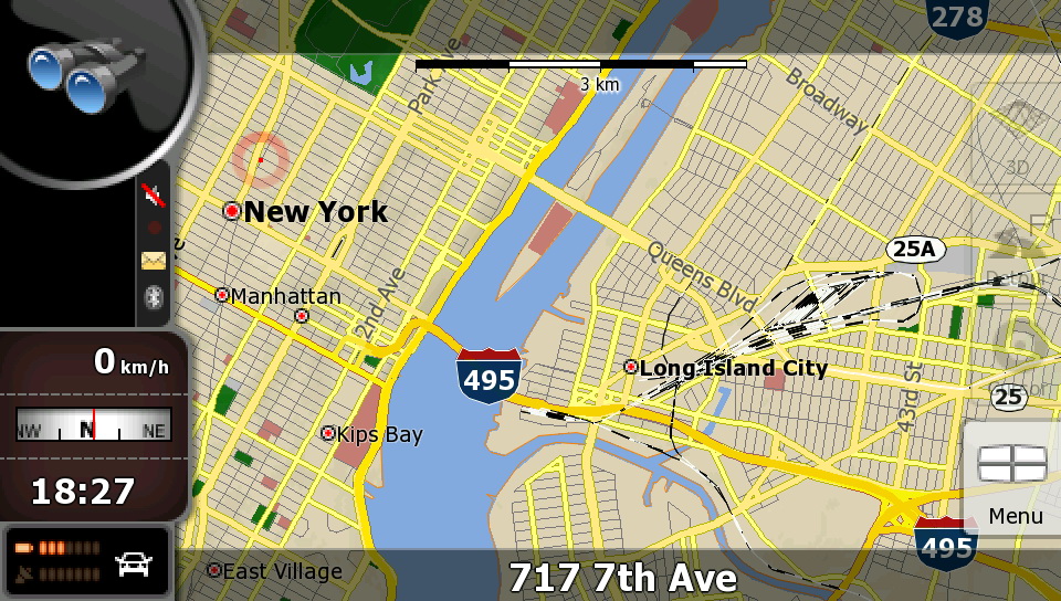
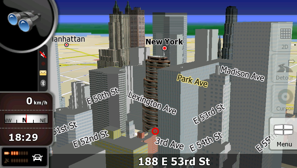
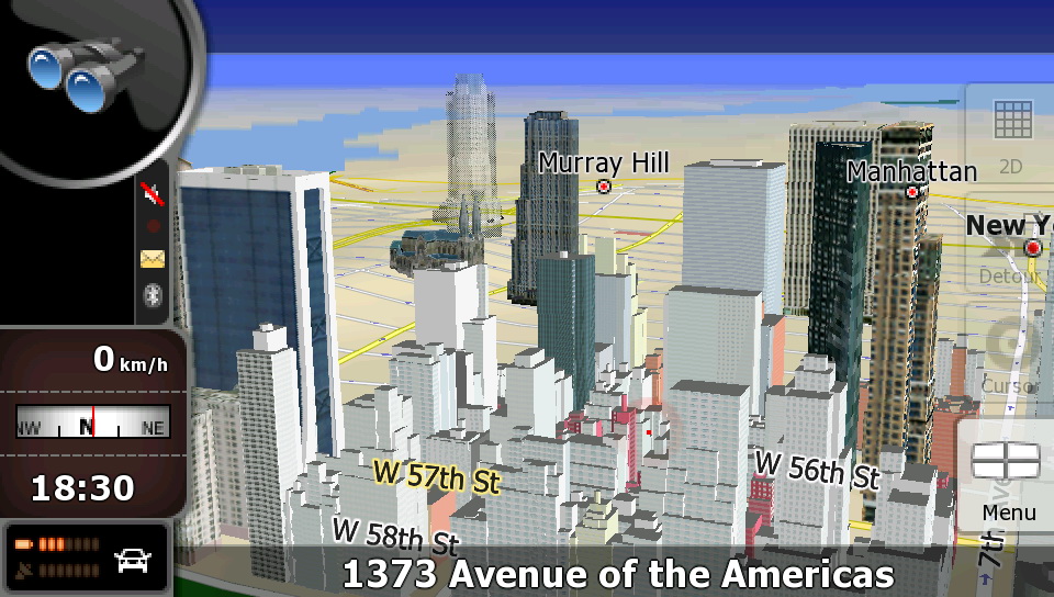
iGO 8

Infinite Possibilities
iGO 8 remains at the forefront of GPS navigation engines. First introduced in 2008, iGO 8 has undergone continuous refinement and remains the gold standard in 3D navigation that does not require expensive hardware to achieve peak performance.

Main features
The fastest map rendering
Online map update services
Low hardware requirements
Support of various platforms
Customizable user interface
Wide range of features
Extensive content portfolio.

Detailed features
The fastest map rendering
iGO 8 offers the fastest map rendering on any platform with eye catching 3D map view
 Online map update services
Online map update services available - easy updating and extra content downloading at www.naviextras.com
 Customizable user interface
Transparent, user-friendly, customizable user interface
 Wide range of features
Wide range of features implemented for advanced navigation products
 Low hardware requirements
Low hardware requirements, optimized performance
 Extensive content portfolio
An extensive content portfolio is available from providers, together with numerous connected services
 Support of various platforms
Support of various platforms and compatibility with wide range of GPS devices (PNDs, smartphones, automotive, even for non-touch (iDrive type) remote controlled products)

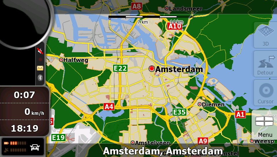
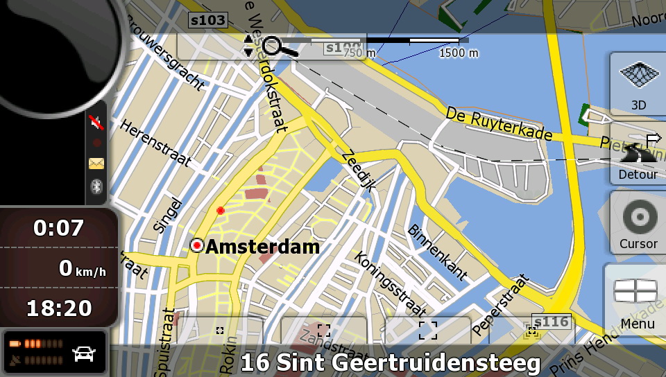
NavNGo_iGO8_Amsterdam

NavNGo_iGO8_Amsterdam

NavNGo_iGO8_Amsterdam

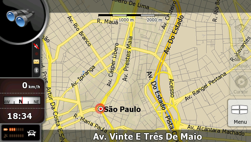
NavNGo_iGO8_Brasil

NavNGo_iGO8_Brasil

NavNGo_iGO8_Brasil

NavNGo_iGO8_Munich

NavNGo_iGO8_Munich

NavNGo_iGO8_NY

NavNGo_iGO8_NY

NavNGo_iGO8_NY

NavNGo_iGO8_NY


Download iGO 8 Map Updates and Extras

How it works
Connect your device or the SD card to your computer
Go to www.naviextras.com
Create a free user account
Download Naviextras Toolbox, a free PC-tool, that connects your device to the PC and automatically scans for installed software and maps
Pick your map or content package and proceed to payment
Follow the prompts to install your latest maps… and you’re ready to hit the road!


Keywords: GPS Maps, GPS Software, Tutorial, Tutorials,  Download, Downloads, NEWS,iGO 8.